Click on the numbers on the map or the name of the area in the list below for details of the area.

Agriculture
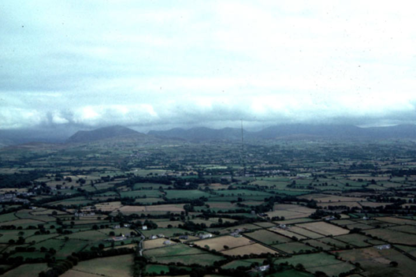
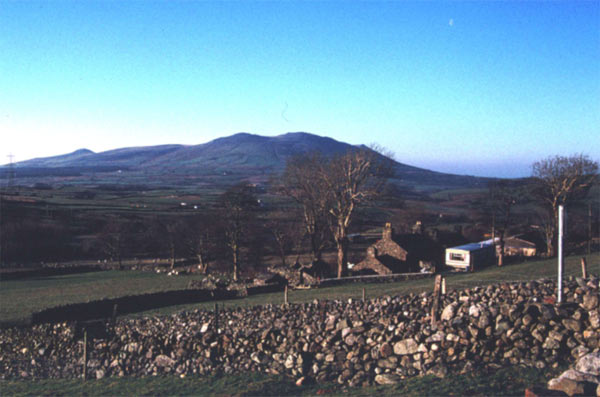
The present day landscape of the area is very much a product of the late eighteenth and the early-to-mid nineteenth centuries. This is not simply in terms of the arrival of large-scale industrialisation, but also of a number of coincident and related factors, such as: enclosure (both legal and illegal) of comparatively large areas such as the Waun Wina, Moel Tryfan/Moel Smytho/Mynydd Cilgwyn (area 14), Nebo (area 15) and Traeth Dinlle (areas 19 and 46); a more pro-active role towards land improvements adopted by the gentry, which included the re-building of Plas Brereton (area 26) and Glynllifon (area 10), as well as the creation of specific estate styles of farmhouses and farm buildings by Newborough and Vaynol; and a more pro-active role taken on by professionals (for example a solicitor at Bryn Bras (area 45), and a land agent at Glan Gwna (area 29).
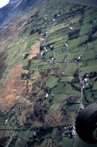
However, this said, there is substantial evidence for the prehistoric origin of many of the field patterns in the marginal parts of the area (i.e. the sea-facing slopes between the largely unenclosed uplands, and the much-improved lowlands).
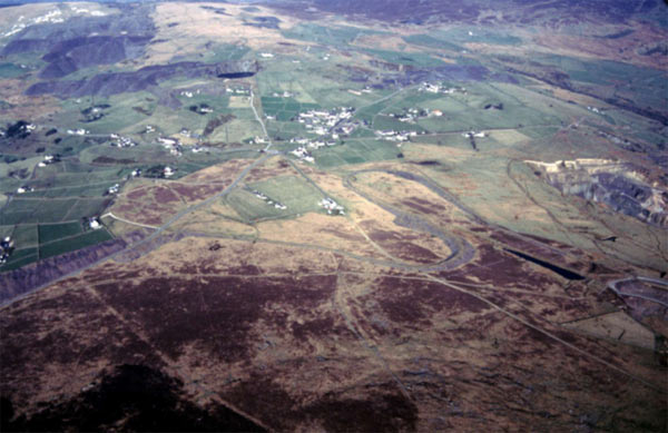
Evidence for prehistoric settlement and associated field systems is perhaps most notable on the enclosed slopes below Mynydd Tryfan, especially the areas around Rhosgadfan/ Rhostryfan (area 22) and Mynydd y Cilgwyn (area 25), which are characterised by stone-built walls, usually circular or irregular in pattern, and often of orthostatic construction. Llwyndu-bach (see illustration for area 25), which was excavated by Bersu in the 1940s, is a good example of a concentric circle enclosure (late prehistoric in date) which has an associated field pattern which radiates out from it. There are other excellent examples to the north (centred on SH505580) and the south (centred SH495570) of Rhostryfan, where an essentially prehistoric fieldscape and settlement landscape has been preserved below later walls.
Another large area of relict (prehistoric) fields associated with settlements is Cae Rhonwy (area 38), although here the relict fields, which appear as grassed-over lynchets rather than in-use stone-walled fields, appear to be sub-rectangular (rather than sub-circular) in shape.
Most of these settlements are scheduled and the scheduled area often includes parts of the (presumably associated) field system. Some of the early lynchets in the Rhostryfan area have been recorded by the Royal Commission (RCAHMW 1960), although unfortunately these are now out of date as much more information has come to light, mainly from aerial reconnaissance. However, other areas have not been adequately recorded, and as none of the field boundaries have been investigated archaeologically, dating is by association only.
It is also possible to detect prehistoric origins in some of the enclosed fields at lower altitudes, again distinguished by the characteristic curvilinear shape of the boundaries, many of which appear to radiate out from circular hilltop enclosures. There are examples around Gadlys (area 36 – SH481580) and probably Llety (area 36 – SH501609).
There are no areas of recognisable former quillets visible in the modern landscape, and indeed none are shown on the relevant tithe maps, even around the farms and houses which preserve medieval township names (such as Coedalun – SH475613, Castellmai – SH498605, Rhedynogfelen – SH465575, Treflan – SH535585 (see area 40), Dinlle – SH435565, Llanfaglan – see below, Llanwnda – see below, Baladeulyn – SH493530, Dolbedin – SH478521, Eithinog – SH455535, Bryn Cynan – SH440531, and Llanllyfni – SH470519 (a present-day settlement)).
Much of the land around and to the south of Caernarfon (areas 1, 28, 29, 30 and 36) was owned by the Church before the Dissolution. Land here belonged to Aberconwy Abbey (Rhedynogfelen – SH465575: the Cistercians came here first from Strata Florida in 1186), Bangor (Llanfaglan – SH470600, and Llanwnda – SH475585) and Clynnog Fawr (Bodellog – unlocated, Gored Gwyrfai – SH45610, Llanfaglan church – SH455606 and Llanwnda church – unlocated). Clynnog had disposed of all of its land in Arfon and Llyn by the late fifteenth century, and all of the other church lands, except those of the Bishops of Bangor, became crown property after the Dissolution.
Vaynol and Glynllifon were the largest estates in the area. The pattern of change on the Vaynol estate, which developed from the Crown manor of Dinorwig, was profound. The earliest maps are the surveys carried out in 1777, which enable a partial reconstruction of the way in which agricultural practices on the estate developed, and detailed surveys dated c. 1800, which contain vast amounts of very useful and interesting material. The estate surveys of 1869 show in some places very regular enclosures which may represent deliberate policy by the estate, elsewhere wandering walls which in some places represent pre-modern settlement, and in others may be a consequence of squatter-encroachment on the wastes before the parliamentary enclosure of 1808, which benefited the Vaynol estate very considerably (CRO Vaynol 4194). The pattern of small holdings established by the quarrymen on the commons was to some extent confirmed and continued by Thomas Assheton-Smith III in order to avoid creating nucleated communities of landless men.
There are several descriptions of the state of agriculture (which contain explicit and implicit references to the nature of the landscape) in Caernarvonshire around the turn of the eighteenth/nineteenth century. In 1794, George Kay produced his General View of the Agriculture of Caernarvonshire (Kay, 1794). Hyde Hall made detailed observations on the state of farming in the area as a result of his travels between 1808 and 1811 (Hyde Hall 1952) (which have been critically analysed by Deiniol Williams (Williams, 1941)), and another contemporary writer, the Revd. Walter Davies makes specific references to Caernarvonshire in his report on north Wales to the Board of Agriculture (Davies, 1810).
There appears to have been a close correlation between the quality of the farming and the state of the fences (a term which included stone walls (Kay, 1794, 146). Building the latter was, of course, a considerable enterprise, as indicated in the statement, relating to properties in the parish of Llanllyfni, that ‘a strong wall has been made at the joint expense of all these tenants between the Upper Ffrith and sheepwalk and the enclosed lands to keep off the sheep’ (Kay, 1794, 72).
Other problems were perceived to have been caused by the ‘intermixture of holdings’ (Roberts, 1973, 17), especially with regard to access. This had roots in the past, with the subdivision of a farm upon a lessee’s death, but obviously caused innumerable problems still.
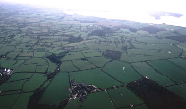
Anecdotal evidence suggests that while the lowland areas have been considerably improved in recent years (with field boundaries being removed), marginal and upland zones have survived largely intact (although a few instances of land clearance have resulted in the loss of archaeological and historical features).
Relict archaeology
The early prehistoric period is relatively poorly represented in the area. The only dated site from this period is the find of a mid-bronze age urn near the base of the standing stone in Glynllifon Park (RCAHMW, 1960, 198). There are also several cairns in the marginal areas, such as the side of Dyffryn Nantlle (areas 37 and 42), which may date from this period, but none has been excavated.
Mention has already been made of the extensive prehistoric settlements and associated field systems covering large areas of the lower mountain slopes, around the edges of the unenclosed mountain land, especially around Rhostryfan and Rhosgadfan. The settlements at Hafotty Wernlas and Llwyndu Bach have been excavated and produced material from the 2nd to 4th centuries AD, but as these were not ‘modern’ excavations they cannot be relied upon to have produced a detailed chronology (RCAHMW, 1960). This area contains some of the most extensive and well-preserved prehistoric remains in north Wales.
Several similar, but now ‘isolated’, settlement sites exist within both marginal areas (for example, areas 25, 37 and 42) and to a lesser extent within the improved fieldscapes of the lowlands (areas 34 and 36). Usually these sites comprise the remains of (prehistoric) hut groups situated in the corners of improved fields (for example near Saron, SH465592), but single hut circles also survive (for example at Penbryn Mawr, SH462539), often below later remains.
The lower part of the Arfon plateau is dominated by the huge multivallate hillfort of Dinas Dinlle (SH550653 – also associated with the Mabinogion), and there are several smaller ‘ring forts’ on other hills inland, for example at Bryngwydion (SH441535), Foel (SH450505), Gadlys (SH 481580) and Hen Gastell (SH471574). Unfortunately, none of these small forts has been excavated, and although they are assumed to be prehistoric in date they do look remarkably similar to the Irish ‘rath’ sites, and the relationship between them and the hut group settlements has not been established: the potential for future analysis is considerable.
There is an interesting (again undated) sub-square enclosure at Dinas y Prif (SH460576), which occupies a low-lying position just above the Foryd, and which is adjacent to a series of hut circle settlements.
The distribution of deserted ‘long hut’ settlement sites, usually taken to be medieval in date, coincides largely with the relict prehistoric settlement remains, i.e. in marginal areas around the edges of the unenclosed mountain land (areas 25, 37 and 42). There is a well-preserved series of sites, along with ridge and furrow cultivation, which was recently discovered along the southern ridges of Dyffryn Nantlle (in an area around SH510520). They occur more rarely in improved fields, usually as isolated features and often overlying earlier sites (for example at Penbryn Mawr – SH462539). Again, the precise date and nature of these sites has not been examined.
Recent aerial photography has begun to demonstrate the potential for discovering further relict sites (mainly hut circle sites, often with associated field system remains, within the improved fieldscapes of the Arfon plateau just to the north of this area, and it would seem likely that, given the right conditions, there are plenty of buried sites awaiting discovery.
Settlement
Overview
As with other areas of Wales, the influence of powerful landowning families remains very evident in the landscape. The most powerful family within the study area were the Wynnes of Boduan and of Glynllifon, ennobled as the Lords Newborough from 1787, at a time when, ironically, their influence in the county was beginning to wane. In addition, several substantial Caernarvonshire estates, whose centres lay outside the present study area, also held land here, primarily Vaynol, as well as a number of gentry estates such as that of the Garnons family, Griffith of Cefnamwlch and Bryncir of Bryncir and their successors.
Archival coverage for the area is remarkably good, including not only the very extensive Newborough and Vaynol archives in the Caernarfon Record Office but also the papers of the various smaller estates and the papers of the major legal practices of the late eighteenth and early nineteenth centuries, in particular those of Henry Rumsey Williams, Caernarvonshire’s leading Tory solicitor, of Owen Poole and of John Evans of the Porth yr Aur practice. The importance of these three collections can hardly be over-estimated, including as they do not only their occasional consultancy on behalf of the largest estates but also their work for the smaller landowners. In many instances these archival holdings include map coverage from the late eighteenth century, before the population explosion and quickening of the pace of landscape change in the early nineteenth, as well as documents from the medieval period.
Few of the farms recorded by estate or tithe maps in the eighteenth and nineteenth century were large. Few were more than fifty acres in extent, and many no more than twenty. In the case of those which formed part of the greater estates, there is occasionally some ‘polite’ architectural influence apparent in the design of the farmhouse (e.g. Penbryn Mawr), and the larger of these tend to have farmyards immediately adjacent, sometimes including traces of an earlier dwelling.
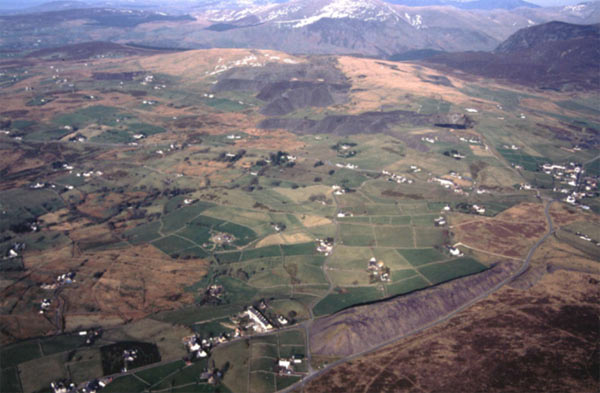
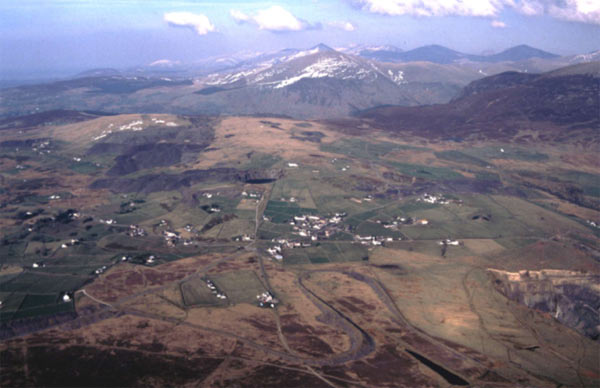
A distinctive form of settlement, particularly evident on Moel Tryfan (area 14), in Nebo (area 15) and above Waunfawr (area 16), is the small cottage within a small regular enclosure or parc, either by itself or as part of a broader pattern of such small holdings. These reflect the growing demand for labour in the slate industry and population pressures evident from the late eighteenth century. Those on Moel Tryfan are believed to have originated from 1798 onwards, and by and large the present pattern of enclosure is already established by 1888 when the first 25 inch Ordnance Survey maps were produced. The less complete map coverage for earlier years suggests that enclosures were well advanced by the 1820s, and probably reached more or less their present extent in the 1860s. Those on Nebo are slightly later in origin than Moel Tryfan (Chapman 1992), whereas those on Waunfawr are believed to represent encroachment from the 1760s (Hobley 1921). Whilst many of these dwellings are unimproved crog-lofftydd, sometimes with lateral extensions, these areas are remarkable for the variety of housing styles they exhibit. From the 1930s onwards, as smallholdings became united, many of the associated dwellings ceased to be inhabited and others were demolished to make way for more modern houses.
Isolated settlements
In a number of places within the study area, isolated farms survive, such as at the head of the Nantlle valley (principally areas 11 and 42), where the farms Ffridd, Gelli Ffrydiau, Talmignedd and Drws y Coed preserve the boundaries evident on estate maps of the late eighteenth or early nineteenth century, though the dwellings themselves are mostly substantial nineteenth-century farmhouses.
Dispersed settlements
Over much of the study area, dispersed settlements, whether of farmsteads or of high-status houses, are evident. These include a number of substantial landowning houses.
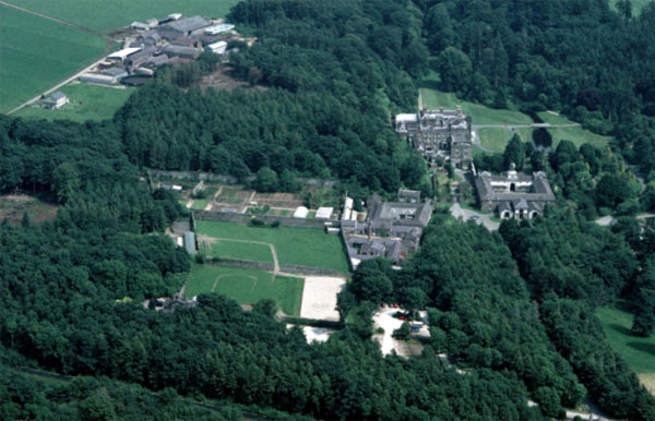
The most important of all, in terms of political and economic influence, was Glynllifon (area 10), where a house of c. 1600 was replaced by a more modern house c. 1761, apparently designed by Sir John Wynne himself. A copy of the plan of the demesne as it was in this period survives in the Caernarfon Record Office. Part of this structure survives in the later Renaissance-style house erected between 1836 and 1848; this, together with the stable of 1849 (RCAHMW 1960, 186) and the slightly later estate workshops and other buildings, were taken over by the County Agricultural College after the war, but the future of the entire complex is currently uncertain. The demesne was emparked in the 1830s, which resulted in the demolition of a number of smaller farms.
Lesser landowning houses were Parkia (Parciau – now demolished), Plas Brereton (both area 26, near Caernarfon), and Dinas (area 36), typically late eighteenth-century or nineteenth-century dwellings in which the influence of polite architectural style is manifest. Polite influence is apparent in diminishing degree to the level of their larger tenanted farms.
Denser settlements of dwellings with smallholdings attached are evident above the former mountain wall on Moel Tryfan (area 14), at c. 250m OD, typically crog-lofftydd, sometimes with lateral extensions and perhaps a beudy. The social and economic pressures which brought these into being are mentioned above. In a number of locations, short terraces of two-up-and-two-down dwellings have been constructed, possibly representing speculative building by cottagers with little capital (see Tal y Sarn – area 7).
Nucleated – village settlements
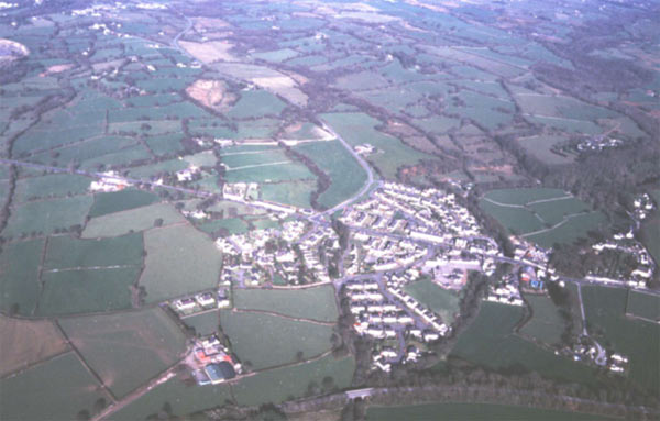
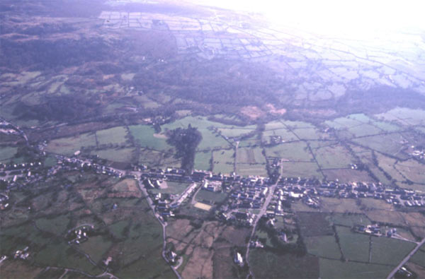
The villages of Llandwrog (area 5), Dinas-Llanwnda (area 3) and Llanllyfni (area 12) are centred on churches which are probably in each case an early Christian foundation (all have Celtic dedications). However, all three settlements assumed their present form in the nineteenth century, Llandwrog as an estate village under the patronage of the Lords Newborough of Glynllifon, with its substantial church, designed by Kennedy, and its markedly estate-derived architecture, Dinas-Llanwnda owing to its location on a road- and later also a rail-junction, and Llanllyfni as a dormitory village within the Nantlle slate quarrying belt.
Otherwise nucleated settlements within the study area are of purely nineteenth-century origin and came into being to service the slate industry. Several different examples are to be found within the Nantlle area. As well as Llanllyfni, where the nineteenth-century houses spread out as a ribbon development from the medieval core, settlements include Pen y Groes (area 6), originally a smithy on a road junction, developed as a village by the Bryncir estate from c. 1820 onwards (NLW H.Rumsey Williams papers), Tal y Sarn (area 7), constructed by speculative builders in the 1850s and ‘60s on the lands of Coedmadog farm, and Nantlle (area 13), in part an ad-hoc development of the 1850s, in part a ‘company village’ erected by the socially-conscious Unitarian management of Pen yr Orsedd quarry from the 1860s onwards. At Drws y Coed (area 11) are the remains of a miners’ village, dating perhaps from c. 1830 (CRO Vaynol Papers 6871), in which a number of houses remain inhabited, though others are roofless and dilapidated. These various settlements demonstrate the varieties of nucleation and building in communities associated with extractive industry and community infrastructure in the shape of chapels, shops, banks and post offices.
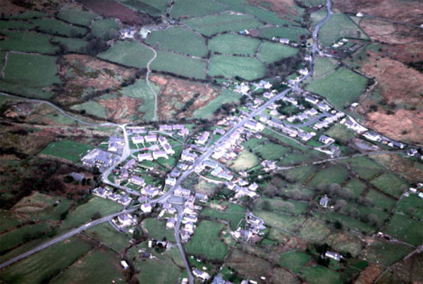
Other specifically quarry- or mine-nucleations within the area are Waunfawr (area 16), Rhostryfan, Rhosgadfan (area 22), Fron (area 21) and Carmel (area 24). These came into being as a result of encroachment on common land, and represent clusters of tai moel (landless houses) within areas otherwise colonised by smallholdings (Gilbert Williams 1983). In many instances the original vernacular dwellings of the early nineteenth century survive, mixed in with later structures; in the case of Waunfawr, the pattern of the village is dominated by the late nineteenth century ribbon development, which partly obscures the ad-hoc and disordered community which preceded it and which survives upslope from the road.
The village of Groeslon (area 4) appears to have grown up around a smithy situated on the crossroads of the main north-south turnpike and the side roads to Llandwrog and to the Moel Tryfan commons. Land here was released for building, under strict quality controls, by Lord Newborough from 1870 onwards (CRO: XD2/6656, 6657, 6659).
One nucleated community has largely disappeared. The Foryd creek (largely area 31), as well as being the landing place for agricultural produce and lime in the late eighteenth and early nineteenth century, had also been used since time immemorial to ship slates from Cilgwyn. Though it was only suitable for vessels of shallow draught, it continued to perform this function until the opening of the Nantlle Railway in 1828, its relative inconvenience compared with Caernarfon outweighed by the fact that the roads which led to it made it possible to avoid paying tolls at Dolydd and Pont Seiont gates. However, the houses and taverns which formerly stood along the shore are now no longer extant, leaving only the lime-kiln as evidence for its former role (UWB: Porth yr Aur 1937).
Nucleated – urban settlements
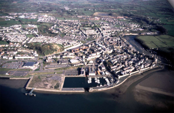
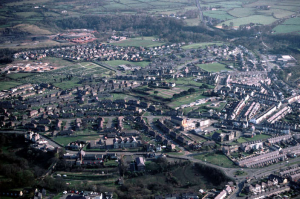
The only pre-modern nucleated settlement in the study area is Caernarfon (area 01), traditionally ‘the town’, y dre’, as Bangor is ‘the city’, y ddinas. The site of a Roman fort, later of a Welsh royal llys and its associated settlement, the present town preserves its medieval street pattern within the town walls and is dominated by the Edwardian castle and those walls. Early maps, such as Speed’s of 1612, show the town beginning to grow beyond its medieval confines, a process that only accelerates in the early nineteenth century, with the increase in slate, and to some extent copper, exports. The bulk of the surviving housing stock dates from this period, though some older town houses survive within the town walls, in some cases in a state of extreme disrepair.
Building types
Even though the great bulk of surviving housing stock in the study area reflects the growth of the slate industry between 1800 and 1900, types of housing vary considerably. In terms of the morphology of individual dwellings, they vary from two-room structures in the miners’ village at Drws y Coed (area 11), through crog-lofftydd (area 14), to two-up-and-two down types and to substantial double-fronted dwellings which nevertheless retain something of the vernacular. Examples of all these different types can be seen as detached dwellings or forming part of a row, generally a short one. A distinctive type which is particularly common on Moel Tryfan (area 14) is built to the traditional crog-lofft pattern but has noticeably large windows. This may represent the activities of one particular jobbing builder, but the size of the windows, especially compared to the small windows of earlier encroachment dwellings, may suggest a drop in the price of fuel, possibly a transition from locally-dug and -carted peat to coal brought in by rail.
A number of anomalous housing types were identified. The pyramid-roofed one-chimney house seems to have been a favourite of the Glynllifon estate in the 1820s; local tradition connects them with the architectural taste of Maria Stella Petronilla, Lady Newborough, and examples were noted at Llandwrog (area 5) as well as elsewhere on the estate outside the present study area. Another instance survives at Rhosgadfan (area 22), a rare example of a gentry-inspired design on the mountain commons, sitting incongruously amongst vernacular-derived terraces. A tall three-storey terrace at Pen y Groes (area 6) is known locally as the tai American (‘American houses’), and may well represent the work, or at least the inspiration, of an emigrant builder who decided to return to his roots. Patterns of emigration are evident in house names like ‘Spokane’ (Pen y Groes) and ‘Dakota’ (Llanberis).
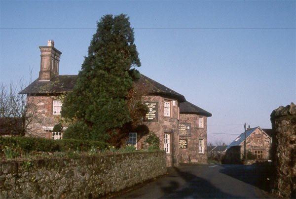
The coming of the national railway system is also clearly reflected in building materials. Brick, mainly yellow but some red as well, is commonly used in later nineteenth-century buildings, but instances of its use decline markedly more than a mile or two from the nearest station. Local field stones are very common, though there are some instances of coursed stone, and the use of quarry ‘rags’ (waste blocks), to build sheds and outhouses, and occasionally dwellings. In Caernarfon (area 1) the use of the locally-quarried pink sandstone is common. Most of the buildings in the quarry villages which came into being, or expanded rapidly, in the 1860s are stuccoed, and it is clear that this is due to the poor quality of the stone available by that stage, combined with the pressure to complete buildings cheaply.
The purple-blue-grey Arfon slate is practically universal as a roofing material, with the larger and less finely-grained slates predominating on buildings from before the 1840s. Patterned slate roofs are very rare.
Decoration on the more architecturally pretentious housing erected in the late nineteenth century remains very common. Wrought-iron work, in the shape of canopies, fencing and gates, is frequently very elaborate, the product of local smithies or of the (still operational) Brunswick Ironworks at Caernarfon (area 1).
Within the study area, the ‘traditional vernacular’ can perhaps be defined as dwellings that effectively represent a development from the medieval conception of the house as a one-cell unit, through the division into two cells, as at Drws y Coed (vide Jeremy Lowe), then into two cells, one of which is sub-divided horizontally by a loft. They can be characterised by their use of locally-available building materials. In its pure form, each house is conceived as a separate, free-standing unit.
In the ‘industrial’ tradition, however, the dwelling is conceived as part of a larger planned group, generally a terrace or row (though blocks of flats are evident elsewhere in Wales from the late eighteenth century), making use of limited ground space by developing on two- or three-stories, and also making use of commercially available, non-local building materials. However, there are few examples of this type within the study area.
In the ‘industrial vernacular’ tradition, however, the dwelling combines elements of both of the above. Typically in Gwynedd, the vernacular element is the use of stone as the main building material, while the industrial element is the two-up-and-two-down unit. The move from the strictly vernacular to this sort of building is perhaps the most significant step taken locally in building tradition, there are, elsewhere in Gwynedd (Cwm Penmachno for instance) some interesting stages on the way. The earliest distinctly ‘industrial’ building in the Nantlle-Caemarfon area is probably Treddafydd in Pen y Groes (1837- area 6). However, there are also interesting examples of the development of local building traditions, such as the industrial interpretations of the vernacular exemplified in the cottages alongside, but at right-angles to, the road from Rhos Isa’ to Rhosgadfan (area 22).
One final category which can be identified is the ‘estate vernacular’ in which dwellings re-interpret vernacular features in a consciously polite way, a style which could be described as the cottage ornée. These are probably best exemplified in this area by the ty uncorn, whether in rows as at Llandwrog (area 5), or singly as at Rhosgadfan (area 22 – a most unusual and striking building). Again, these are characterised by the use of local materials and/or the discreet use of commercially-produced materials, and consciously picturesque detailing.
Place-name evidence
Few published studies have explicitly analysed place-name evidence within the study area, although Melville Richards’s Enwau Tir a Gwlad (Richards 1998) is a valuable source, and the Ar Draws Gwlad (Pierce and Roberts 1997) series includes a number of Arfon place names.
Industrial
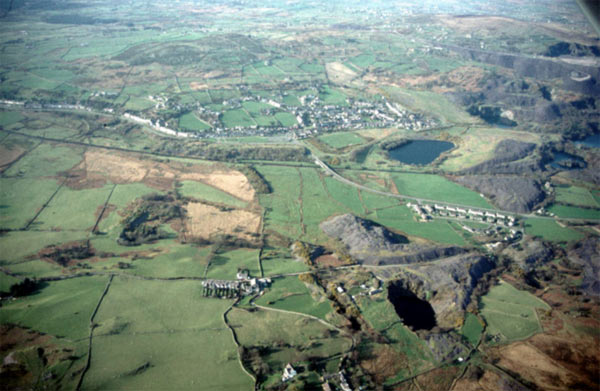
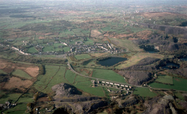
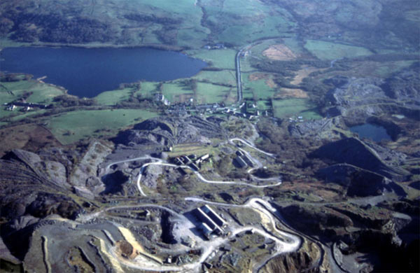
The chief industry of the study area was the quarrying of slate, which has now practically come to an end. The Nantlle (area 9) and Moel Tryfan regions (area 14) together represented the fourth most productive area of slate quarries in Wales, after the Ogwen and Peris areas and Blaenau Ffestiniog. Since they were the property of many different owners – the crown, minor local gentry, or wealthier magnates such as Lord Dinorben – the slate veins had to be exploited in a number of different but immediately adjacent quarries, with the result that the area never realised its full economic potential. This fact is reflected in the dual economy of quarry and smallholdings which persisted well into the twentieth century, and which has still not entirely died out, and in the strong vernacular character of the housing stock which the quarrymen constructed for themselves.
In the Nantlle area (areas 9, 13 and 14), by the early eighteenth century, gangs of quarrymen were working the rocks on the upland Cilgwyn common, paying no rent and calling no man master, and before the end of the century quarries had also been opened on the valley floor (area 9), where the excellent quality of the rock made quarrying profitable despite the problems of pumping and raising rock from the pits.
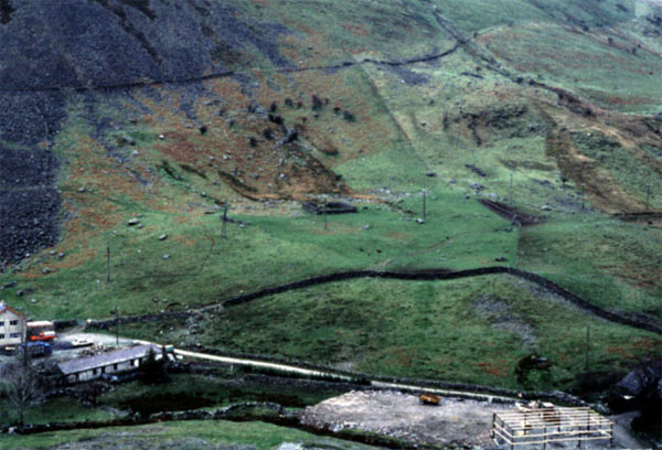
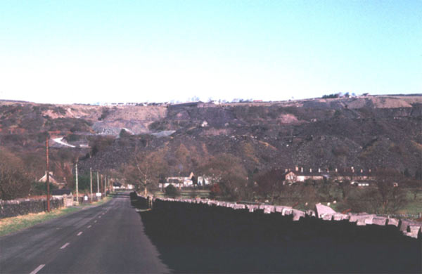
The extensive map coverage for this area in the period 1813 to 1816 (CRO Glynllifon 8356, NLW: Garnons estate survey, UWB Llysdulas ) reveals a number of quarries already developed, alongside tiny scratchings which in some cases later grew to a considerable size. By this period the original benches on hillsides or shallow diggings in the river meadows had given way to the area’s characteristic deep pits, making use of pump-machinery and rope-ways for haulage. The use of chain inclines (from c. 1842) and blondins (from 1898) bequeathed some of the distinctive industrial archaeology of the region, including the enormous slate bastions used to tip rubble. The early (1868 onwards) use of mills and an intensive factory-type approach to processing slate, compared with other slate quarrying regions, is also reflected in the surviving archaeology (CRO Pen yr Orsedd 375). A feature of the industry in Dyffryn Nantlle is the reliance of the quarries on water-power, mostly fed by an extensive system of leats from Llyn Ffynnonhonau, dating from 1816. Quarrying has now all but ceased in Nantlle.
Of the independent slate mills which formerly flourished in the area, one, the Inigo Jones slate works, remains in production, processing blocks brought in by road from Aberllefenni Quarry in Corris. Two writing slate mills on the banks of the Llyfni have been converted into dwellings; one is situated between Pen y Groes and Llanllyfni, the other at Pont y Cim.
Mineral extraction was carried out on an extensive scale at the head of the Nantlle valley, on Drws y Coed, Simdde Dylluan, Tal Mignedd and Benallt farms (area 11), where mines yielded copper, some lead and a little gold. Medieval working is indicated by a number of coffin adits on the higher reaches of Drws y Coed, and the mine was worked extensively from 1768 to the later eighteenth century (CRO: Vaynol 5047), a phase of working which is evident in the distinctive adit entrances, shelters and anvil stones for breaking ore (bucking stones) on Fron Felen, and in early phases of mechanisation. Operations were revived in the Victorian period, and continued as late as 1920 at Simdde Dylluan and Drws y Coed and as late as 1931 at Benallt (Bick 1985, 33-50). The ironstone mine at Garreg Fawr forms a spectacular landscape feature, with its series of openings following the vein up the hillside and the incline system.
The brickworks at Caernarfon (area 28) continue to operate and have now grown to a considerable size. Clay is extracted from a pit on site, and the entire process of brick-manufacture is carried out in one large building. The Hoffman kilns associated with the earlier phase of operations have been demolished.
Water-powered corn milling is attested from 1283, with the establishment of the royal mills on the Cadnant brook at Caernarfon, though it is possible that they were preceded by a Cistercian mill, possibly at Felinwnda (area 36) (Williams 1990, 36). Legal papers record the construction of corn mills on the rivers that flowed through Caernarfon in the late sixteenth century, when the Puleston family were forced to defend their monopoly (Taylor 1986, 80; Jones 1939, 49, 65-6; Lewis and Davies 1954, 275, 284). The sites of, and in many cases the buildings associated with, corn mills survive in a number of locations. The surviving structures are for the most part nineteenth-century, and vary in size from the comparatively small as at Melin Nantlle through Melin Llwyn y Gwalch, with its distinctive low-pitched regency roof, to the substantial box-like mills at Bontnewydd and at Seiont nurseries (area 30 – see photograph).
Of the area’s textile mills and pandai, little remains, though a considerable number of sites are recorded. A number of structures are identifiable and the sites of water-courses survive.
Communications
There is comparatively little evidence for pre-modern transport routes. The Roman roads from Caerhun to Segontium (Caernarfon), and from Segontium to Pen Llystyn (Bryncir) passed through the area, and it is reasonable to suppose that the latter route lay in part on the same general alignment as the modern A487 (Waddelove 1999, 223-45). Late eighteenth-century maps (CRO: XD2A/1643) show a presumably ancient route from Caernarfon to Penmorfa (where a Roman bath house was discovered in the nineteenth century), sending off branches in the direction of Clynnog and Rhyd Ddu, and it is known that this route was realigned and substantially upgraded by Huddart of Bryncir and Newborough of Glynllifon in the 1820s, with some of the survey work being carried out by Provis, Telford’s assistant (CRO XD2A/1646). This road, and the Caernarfon-Beddgelert road, upgraded c. 1806 (CRO X/Plans/RD/1), preserves much of the engineering of an early nineteenth-century turnpike, in the shape of bridges and embankments, as well as some of the associated infrastructure, such as taverns.
More recent road-building includes the Nantlle diversion, constructed in the 1920s as a result of the collapse of the old turnpike into Dorothea Quarry, and the Llanllyfni by-pass, on which work began in the autumn of 1999.
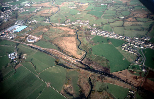
The Nantlle Railway, constructed between 1825 and 1828 from the Nantlle quarries to the sea at Caernarfon to plans drawn up by Provis and the Stephensons, survives as a landscape feature thoughout most of its length, though some of its assets are under threat from modern road construction (Gwyn 1999). Road schemes are having an adverse impact on its successor, the standard-gauge Caernarfon to Afonwen line. The track-bed of the Welsh Highland Railway is currently (2001) being relaid by an organisation which is well aware of the heritage significance of the route, though it has proved necessary to alter some of the bridges in order to accommodate locomotives larger than the originals. One section of the route which it is not proposed to revive is the branch to Bryngwyn and the tributaries to the Moel Tryfan quarries, which combines both rope-worked inclines and corkscrew curves, and illustrates the development of narrow gauge railway technology as it grew from the hybrid systems of the early nineteenth century into a form which was adapted for British imperial needs in Africa and India (Martin 2000).
Caernarfon (area 1) also preserves an outstanding nineteenth-century dock landscape, including the sites of engineering works, still active in the case of the Brunswick Ironworks, the port office and warehousing.
Air transport is represented by the airfield at Llandwrog (area 46), now marketed as Caernarfon Airport, a site which was extensively developed by the RAF during the Second World War from 1940 onwards (it became the largest airfield in Wales), and in 1946 became a storage area for chemical weapons (loan 1991, 79-105). Many of the buildings and runways survive; one of the former is the recording studios of Recordiau Sain.
Other forms of communication system which have left their mark on the area include the pioneering Marconi wireless station between Waunfawr and Llanrug (area 42).
Defence
The huge hillfort of Dinas Dinlle (area 19) dominates the low-lying area south of the Foryd, and probably dates from the late prehistoric period. In addition to this, a number of small hilltop enclosures are known within the area (see above, paragraph 8.2.4).
Caernarfon itself (area 1) forms the most prominent defensive site within the area, in the form of the Edwardian castle and town walls built in conscious imitation not only of the Theodosian walls at Constantinople but possibly also the caer at the mouth of the Afon Seiont described in ‘Breuddwyd Macsen Wledig’. The castle is a World Heritage site.
Other defensive sites from the modern period are represented in the area. In the demesne at Glynllifon is Fort Williamsburg (area 10), constructed c. 1761 with additions in 1773, a rectangular enclosure indented to form angle bastions with an ornamental gatehouse. This was an elaborate folly, and Lord Newborough even raised his own regiment to garrison it.
The other defensive site associated with Glynllifon is Fort Belan (area 46) at the western approach to the Menai straits, believed to have been constructed during the American revolutionary war, but also garrisoned in readiness to repel invaders during the Napoleonic wars. A dock was added in 1824. The fort itself is a north-south orientated rectangular structure with salients in the shorter sides, and contains early cannon and marine machinery. A gun battery was also established outside the Caernarfon town walls (area 1) between Porth yr Aur and the Eagle Tower during the Napoleonic period.
Caernarfon Airport was established as RAF Llandwrog, a training airfield, in July 1941, and went on to become the largest airfield in Wales during WWII (Sloan 1991). Additional gun placements were built in the lower slopes on the north side of Dinas Dinlle. The airfield is now in civilian use.
Bibliography
- Bick, D., 1985, The Old Copper Mines of Snowdonia (Newent)
- Chapman, J., 1992, A Guide to the Parliamentary Enclosures in Wales
- Davies, W., 1810, General View of the Agriculture and Domestic Economy of North Wales, The Board of Agriculture and Internal Improvement, London
- Gilbert Williams, W., 1983, Moel Tryfan i’r Traeth (Penygroes)
- Gwyn, D.Rh., 1999, ‘Transitional Technology: the Nantlle Railway’, Proceedings of the Durham International Early Railways Conference 1998 (Beamish)
- Hobley, W., 1921, Hanes Methodistiaeth Arfon
- Hyde Hall, E., 1952, A Description of Caernarvonshire (1809-1811), Caernarvonshire History Society, Caernarfon
- Jones, E.G., 1939, Exchequer Proceedings (Equity) Concerning Wales (Cardiff)
- Kay, G., 1794, General View of the Agriculture of North Wales, Great Britain Board of Agriculture and Internal Trade, Edinburgh
- Lewis, E. A. and Davies, J.C., 1954, Records of the Court of Augmentations Relating to Wales and Monmouthshire (Cardiff)
- Martin, T., 2000, Halfway to Heaven: Darjeeling and Its Remarkable Railway
- Pierce, G.O. and Roberts, T., 1997, H.W.Owen, Ar Draws Gwlad: Ysgrifau ar Enwau Lleoedd cyf. 1 (Llanrwst)
- Richards, M., 1998, Enwau Tir a Gwlad, Caernarfon
- Roberts, R. O. (ed), 1973, Farming in Caernarvonshire around 1800, Caernarvonshire Record Office, Caernarfon
- Royal Commission on the Ancient and Historical Monuments of Wales (RCAHMW), 1960, Inventory of Caernarvonshire: Centre, volume II, HMSO, Cardiff
- Sloan, R., 1991, Wings of War over Gwynedd (Llanrwst)
- Taylor, A.J., 1986, The Welsh Castles of Edward I
- Waddelove, E., 1999, The Roman Roads of North Wales: Recent Discoveries (privately published)
- Williams, D., 1941, An Eye witness account of agrarian conditions in Caernarvonshire during the Napoleonic era, Caernarvonshire Historical Transactions, vol 3
- Williams, D., 1990, Atlas of Cistercian Lands (Cardiff)