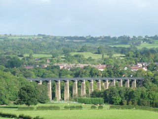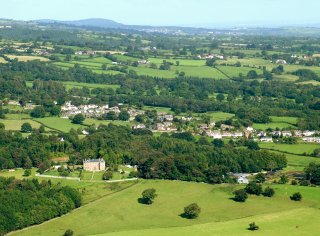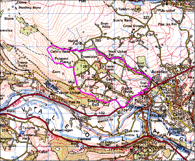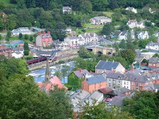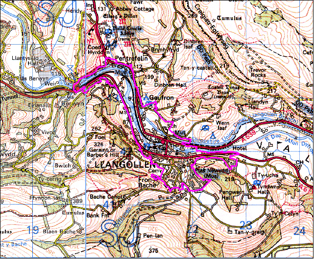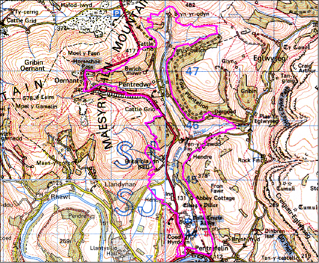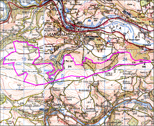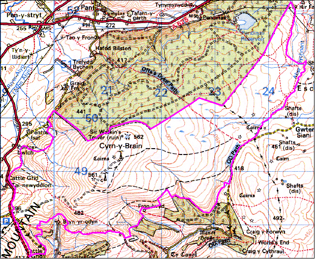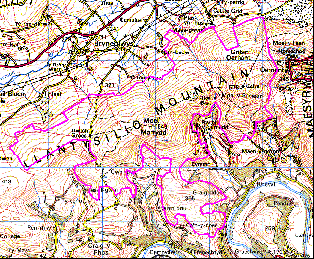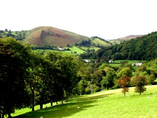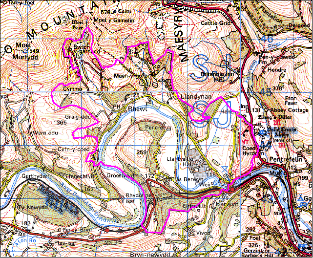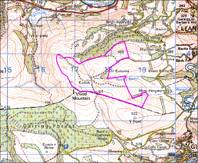
The following description, taken from the Historic Landscapes Register, identifies the essential historic landscape themes in the Vale of Llangollen and Eglwyseg historic landscape area.
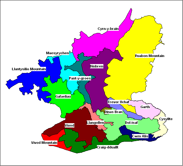
Character areas defined in the Vale of Llangollen and Eglwyseg Historic Landscape
The Vale of Llangollen in North East Wales presents a remarkable visual combination of stark natural landforms and ancient and modern man-made features. Geomorphologically the vale is a broad rift valley, dominated on the north by the towering limestone cliffs of Eglwyseg Mountain. The cliff tops gradually gain in height from 300m above OD at their southernmost point overlooking the middle of the vale, to 450m above OD at their northernmost point overlooking the upper reaches of the narrow tributary valley of the Eglwyseg river. On the south side of the vale, the slopes rise steeply to 400m above OD along the summit of the ridge that divides the vale from the Ceiriog valley to the south.
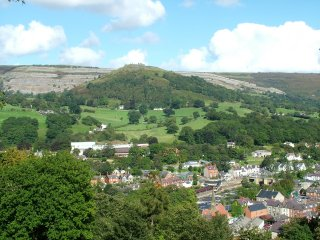
The flat floor of the vale is about 100m above OD and contains the winding course of the River Dee, although at Llangollen, the vale narrows into what is more characteristically a river valley, first turning north and then west to continue beyond the part of the vale described here. Overlooking Llangollen from the east are the imposing remains of Castell Dinas Brân, a medieval masonry castle located within the earthworks of an earlier, Iron Age hillfort. The site occupies the summit of a steep sided, conical shaped hill which rises spectacularly to 320m above OD out of the valley floor and is topped by the picturesque ruins of the castle which was possibly built by Gruffydd ap Madoc, son of the founder of Valle Crucis Abbey.
The Cistercian abbey of Valle Crucis lies near the confluence of the Eglwyseg and the Dee north of Llangollen, and was founded by Madog ap Gruffydd in 1201 as a colony of Strata Marcella near Welshpool. The now ruined abbey buildings are typical of many Cistercian foundations, lying in a secluded river valley surrounded by farmland. Local folklore associates Valle Crucis with Owain Glyn Dwˆ r who disappeared in about 1410 after the failure of his rebellion against the English.
The fragmentary 9th-century cross, the Pillar of Eliseg, is set on a small circular mound which is perhaps a Bronze Age barrow, just to the north of the Abbey. The cross has a Latin inscription which is now too eroded to read, but according to a transcription of 1696, celebrated the glories of the house of Powys and recorded that the stone was erected by Cyngen in honour of his great-grandfather Eliseg.
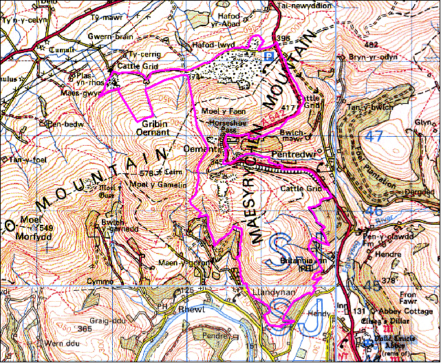
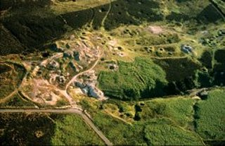
At the northern end of the Eglwyseg valley, at World’s End, lies the impressive timber-framed manor house Plas Uchaf which bears a date of 1563. West of the Eglwyseg valley, the northern limit of the landscape is dominated by the majestic sweep of the Horseshoe Pass where the road finally climbs over Maesyrychen Mountain, past abandoned 19thcentury slate quarries, and on towards the Vale of Clwyd.
The Dee valley has always been a major communications route and bears the evidence of successive innovations in the history of transport. Perhaps the most notable of these is the Llangollen branch of the Shropshire Union Canal, constructed by Thomas Telford and opened in 1805. From its source at the Horseshoe Falls the canal follows the northern side of the valley before crossing the Dee with the dramatic Pontcysyllte aqueduct, overshadowing its medieval ‘counterpart’ which carried the road over the River Dee. At the northern end of the aqueduct is Trevor Wharf where Telford reputedly stayed during its construction. Telford was also responsible for the construction of the new Holyhead Road, now the A5, which runs through the vale and was recently officially marked as a historic route.
The vale also bears the scars of an industrial past. The limestone cliffs of Eglwyseg have been quarried for centuries both for building stone and as a source of lime. Several lead mines drove adits directly into the cliffs, and the remains of both industries are still to be seen. The north west of the area displays the remains of slate quarrying, including inclines and parts of an embanked tramway, while its southern end is dominated by the industrial complexes of Cefn-mawr and Acre-fair (both currently outside the area described here).
Llangollen itself straddles the Dee via the arched bridge built about 1500. The historic core of the town lies on the southern side, focusing on the church and the river crossing. Later development occurred largely because of the woollen i n d u s t r y, which used the natural power source of the Dee to drive several mills, and then during the 19th century because of the coming of the railway which, although finally closed to traffic in 1968, has now been partly reopened for tourists, as the Dee Va l l e y R a i l w a y. On the outskirts of the town is Plas Newydd, the home of the Ladies of Llangollen who at the turn of the 19th century were renowned patrons of the arts and did much to promote a resurgent interest in Welsh culture. Llangollen has built on these artistic traditions and is now known throughout the world for the International Eisteddfod held annually in the town .
The Making of the Vale of Llangollen and Eglwyseg Landscape
The forces which have helped to form this landscape of special historic interest in Wales are outlined in the following sections.
The Natural Landscape
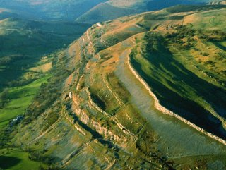
The Vale of Llangollen is a dramatic, steep-sided valley cutting through Ruabon and Llantysilo Mountains to the north and the Berwyn Mountains to the south. In origin it is a broad rift valley, sculpted by the action of glaciers during the last glaciation. Llantysilio Mountain to the west and the Berwyn Mountain to the south are composed of Silurian slates and shales, with Ordovician shales to the north of Cyrn-y-brain. Ruabon Mountain, by contrast, is composed of underlying strata of Carboniferous limestone which form the dramatic escarpment of Creigiau Eglwyseg and Trevor Rocks, overlain by a band of sandstone and by Coal Measures including sandstones and marls which extend towards Ruabon and Wrexham and which outcrop at the south-eastern corner of the study area. The floor of the Vale lies at between about 80–100 metres above Ordnance Datum whilst the surrounding hills rise to over 500 metres.
During the last Ice Age the area was affected by two ice sheets which met approximately along the eastern boundary of the study area, one moving southwards from the Irish Sea and the other which had formed over the mountains of central Wales to the south. Pre-existing river meanders between Llantysilio and Valle Crucis and in Pengwern Vale to the south-east of Llangollen were blocked by ice, forcing the river Dee to cut new narrower river channels, isolating these earlier river meanders. Ice action resulted in a scattering of erratic boulders which are to be found in various places on the surrounding hills. Frost action as the ice retreated gave rise to the scree slopes at the base of the limestone escarpment of Creigiau Eglwyseg. Following the late glacial period alluvial deposits have built up within the floor of the Vale which now contains the meandering course of the river Dee.
Little detailed study has been made of the early environmental history of this part of the Dee Valley or the surrounding hills. However, it is likely that in common with other areas of north Wales that there was a general sequence in the post-glacial period which began with the establishment of pine forest in the early colder periods leading to the development of extensive broadleaved woodland dominated by oak, elm, lime and hazel and birch and alder scrub in the uplands. Much of this original woodland cover has been gradually cleared by human activity since early prehistoric times though some small areas of ancient or replanted broadleaved woodland survives on some of the steeper hill slopes and stream valleys. Some more extensive areas of woodland are recorded in the 14th century. One forest called ‘Cwmcath’ lay on the higher ground to the south of Llangollen and another known as ‘Isclawdd’ lay in the Froncysyllte and Trevor area were managed by the forester of the marcher lordship of Chirkland.
The Administrative Landscape
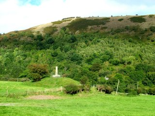
From the 7th or 8th century the area formed part of the Welsh kingdom of Powys. The eastern borders of the kingdom came under threat from the neighbouring Anglo-Saxon kingdom of Mercia whose frontier in the later 8th century was formed by Offa’s Dyke which lies just beyond the eastern boundary of the study area. Eliseg’s Pillar, the lower portion of a stone cross near Valle Crucis, was erected in the first half of the 9th century by Cyngen in honour of his great-grandfather Eliseg who had reunited the kingdom by retaking land which had once been conquered by the English. The siting of this important monument at a focal point of a tributary valley of the Dee, suggests the presence a royal estate here in the Eglwyseg valley in the 9th century.On the death of Gruffudd Maelor in 1191 Powys was subdivided into the kingdoms of Powys Fadog in the north, which included the area of the Vale of Llangollen, and Powys Wenwynwyn further to the south. The area of the Vale fell within the commotes of Nanheudwy to the south, Maelor Gymraeg (Bromfield) to the north-east and Iâl (Yale) to the north-west.
The portion of Powys Fadog containing the commotes Iâl and Nanheudwy, fell to Madog ap Gruffudd who founded the Cistercan monastery at at Valle Crucis in 1201 which subsequently became the dynastic burial ground. Following Madog’s death in 1236 the kingdom was inherited by his son Gruffudd ap Madog Maelor. Gruffudd built the castle at Dinas Brân in the 1260s as the administrative centre of the kingdom, before his death in 1269.

Edward I took possession of the kingdom of Powys Fadog in 1282 during the course of the conquest of Wales by the English crown. Powys Fadog ceased to exist as a separate entity thereafter, and from this time Dinas Brân lost both its military and administrative significance. The land to the south of the Dee, as well as the portion of Iâl which included Dinas Brân and Valle Crucis to the north of the river, were granted to Roger Mortimer, son of Roger, lord of Wigmore, and went to form part of the marcher lordship of Chirkland (Swydd y Waun), administered from Chirk Castle. The remaining lands to the north of the river were granted to John, earl of Warrene, and formed part of the newly created marcher lordship of Bromfield and Yale, administered from Holt Castle.
The gaunt remains of the Welsh medieval Castell Dinas Brân, built within the ramparts of an early Iron Age hillfort by Gruffudd ap Madog in the 1260s.
The marcher lordships of Chirkland, and Bromfield and Yale passed through various hands but continued to be ruled as independent territories until the Act of Union in 1536 when they came to form the hundreds of Chirk, Bromfield and Yale in the newly created county of Denbighshire.
Denbighshire formed part of the new county of Clwyd created in the local government reorganisation of 1974, but was reconstituted again as the unitary authority of Denbighshire in the local government reorganisation of 1996. The community of Llangollen Without, at the eastern corner of the study area, was transferred to Wrexham County Borough Council in 1997.
In ecclesiastical terms the parochial structure of the area was dominated by the Cistercian monastery of Valle Crucis (Llanegwestl) founded in 1201 by Madog ap Gruffudd, the ruler of Powys Fadog, which eclipsed a number of the pre-existing ecclesiastical parishes in the area. The abbey held extensive possessions scattered across southern Denbighshire and depended to a significant extent on its tithes. These included the tithes of the appropriated churches at Llandysilio-yn-Iâl and Llangollen which may have been founded in the 6th or 7th centuries and which in the case of Llangollen had probably formed the mother church of the commote of Nanheudwy. Valle Crucis underwent a long period of decline before its dissolution in 1536, during the reign of Henry VIII.
In the 19th century the parish of Llantysilio was, divided into the townships of Coedrwg, Maesyrychain, Llandynan, Cymmo-Dupart and Cymmo-Traian (Brithdir). The parish of Llangollen included the townships of Trevor Isa, Trevor Ucha, Dinbren, Eglwyseg, Cysyllte, Llangollen Fechan, Llangollen Fawr, Llangollen Abbot, Pengwern, Bache, Vivod, and Rhisgog.
Land Use and Settlement
Prehistoric and Roman settlement and land use
The fertile lands of the Dee valley represented an important economic resource as well as an access route into central Wales from early times, which helps to explain the widespread evidence of human activity in the area during the earlier prehistoric periods.

A more detailed study of the archaeological sites and finds and an analysis of the vegetation history is needed, before a clearer picture can be drawn of the character of early settlement and land use within the area. However, woodland clearance and hunting during the Neolithic and earlier Bronze Age periods, between about 4000–2000 BC, are perhaps represented by occasional chance finds, such as the stone axes that have been found near Moel y Gaer hillfort on Llantysilio Mountain and by those found near Ty’n Celyn and Trevor Hall, and by flint arrowheads like those found near Blaenau Uchaf on the hills south of Llangollen. Despite the lack of known settlement sites, permanent settlement from the earlier Bronze Age between about 2300–1500 BC is clearly indicated by scattered burial mounds such as those at Moel y Gamelin and Gribin Oernant on Llantysilio Mountain, those on the peaks of Cyrn-y-brain overlooking Nant Craig y Moch and Aber Sychnant, and on the hills to the south of Llangollen near Ffynnon-las and Blaen Nant. The monuments on Ruabon Mountain include simple cairns of stone, occasionally with a stone kerb, as well as stone ring-banks and a stone circle which were probably associated with ritual or ceremonial activity.
These upland monuments, frequently sited on hilltops, ridge tops or on hill scarps, are often visible from some distance away. They appear singly or in small groups and are likely to have performed various roles in the the developing landscape of the fourth to second millennia BC, between about 3500 and 1500 BC. Clusters of monuments may represent ceremonial foci within the emerging landscape utilized by man and may have helped to define the activities of different family or tribal groupings. No contemporary settlement evidence has yet been found but it seems likely that the monuments are to be associated in some way with the exploitation of upland summer hunting grounds and summer grazing for domesticated animals, possibly associated with home bases sited in less exposed positions in the adjacent valley lowlands.
Continued activity in the Later Bronze Age period, between about 1200–700 BC, is indicated by chance finds of metalwork possibly to be associated with continued woodland clearance or with warfare, including a small hoard of socketed bronze axes and a leaf-shaped spearhead found in Llantysilo parish and by a single socketed axes found near Pentredwr and on Fron Fawr, east of Valle Crucis, and by two found separately within several hundred metres of the summit of Dinas Brân.
It was during this period or in the succeeding Iron Age period, between about 700 BC – AD 50, that the first evidence of defended settlements appears within the area. These are represented by the hillfort which preceded the medieval castle on Dinas Brân, by Moel y Gaer hillfort on the summit of Llantysilio Mountain, and by Pen y Gaer hillfort, on a spur of Ruabon Mountain to the east of Garth. It is uncertain whether or not these hillforts represent permanently occupied settlements, but it is clearly significant that they are not only sited in locations which are naturally well defended but also give ready access to extensive areas of upland grazing. Dinas Brân, like the subsequent medieval castle appears to control the Dee valley and like both Moel y Gaer, and Pen y Gaer probably represents a tribal centre possibly to be associated with early cattle ranching on the neighbouring moorland.
The narrow valley of the Dee near Llangollen has been of importance since early times, providing a narrow, lowland corridor to the lands of central Wales, further to the west. The strategic significance of the later prehistoric hillfort on Dinas Brân is perhaps emphasised by the fact that in order to avoid being ambushed in the valley in the late 1st century the invading Roman army chose a route across the Berwyns to the south, via the Ceiriog valley, though the hazardous nature of this mountain route to west Wales is exemplified by King Henry II’s disastrous expedition against the Welsh princes in 1165.
Relatively little evidence of Roman activity has been discovered in the Vale of Llangollen apart from a number of chance finds, including a small hoard of 2nd-century coins from near Maesyrychen-bach and a Roman brooch found near Trevor Hall. It is probable, however, that during the course of the later prehistoric and Roman periods an integrated economic system developed that exploited the resources provided by arable farming in the lowlands, woodland resources on the valley edge, and extensive upland grazing. This would have given rise to a gradually evolving landscape probably characterised by scattered farmsteads and associated arable on the lower ground, ever-diminishing areas of native broadleaved woodland and scrub on the more difficult slopes, and extensive areas of heather moorland on the surrounding hills.
Early medieval and medieval settlement and land use

It was from these early beginnings that the early medieval landscape emerged, again probably characterized by a pattern of arable ploughlands, residual ancient woodland, scrub and moorland. What is known about the area in the 14th century suggests that Welsh systems of land tenure by extended family groupings emerged during the early medieval period, between about the 6th and 11th centuries.
It was probably also during this period that the local commotal structure and the pattern of farmsteads, townships and parishes that are known in later history had already begun to develop. A picture of the possible settlement pattern that had evolved by this period is given by a number of early religious centres. A mythical story of the christianization of the area is given in the legendary Life of St Collen, a person associated with the slaying of a giantess aided by her god Arthur, the giant of Creigiau Eglwyseg. The church dedicated to saint Collen at Llangollen may have come into existence by the 6th or 7th century. The former grave chapel, known as the ‘Old Church’ survived here up until the mid 18th century when it was demolished together with the Romanseque shrine it contained, the material being used to build the church tower, replacing an earlier wooden one. Until the church was appropriated by Valle Crucis abbey in the early 13th century it was probably formed the mother church of the commote of Nanheudwy, forming a locally important religious centre both in terms of its geographical location and its association with the cult of saint Collen. It seems likely that an early nucleated settlement grew up in the area of the church, at the river crossing of the Dee. There are suggestions that a small nucleated settlement may also have grown up around Llantysilio Church, which may again have had an early foundation.
The Vale came to form part of the Welsh kingdom of Powys from about the 7th or 8th century, the setting up of the Pillar of Eliseg by a prominent member of the ruling family in the 9th century in honour of his great-grandfather demonstrates the existence of a significant royal estate here at that date probably associated with bonded villages and holdings from which revenue and services were levied. The pillar, the base of a cross set up on a large mound, once bore an inscription relating the ‘foundation myth’ of the ruling dynasty.
Two important 14th-century documents, known as the Extent of Bromfield and Yale and the Extent of Chirkland, were compiled by the marcher lordships for taxation purposes in 1315 and 1391–93 respectively. These provide a fuller picture of the extent of settlement and land use in the 14th century, following the extinction of the native kingdom of Powys Fadog in the late 13th century. The extent to which the native inhabitants of Powys Fadog would have been affected by the creation of the new marcher lordships in uncertain. Unlike the more extensive fertile lands of the Vale of Clwyd and Maelor Saesneg there is no record of lands being confiscated from their original Welsh owners or of the deportation or removal of Welsh tenants taking place to make way for incoming English settlers. Some tenants may have been deprived of their ancient rights to common pasture and hunting, though the marcher lordships may simply have taken over many of the rights formerly held by the native princes. Plas Uchaf, at the head of the Eglwyseg valley, is thought to stand on the site of a hunting lodge of the princes of Powys in the later 11th century.
In the later 14th century tenants of the lordships were still overwhelmingly of Welsh origin and Welsh forms of inheritance known as gavelkind, by which possessions were shared by the heirs, continued to be followed until the later 15th and early 16th centuries. The occurrence of numerous holdings termed gafael in the extents indicates the widespread native tradition of shared rights in arable and pasture by a family group according to Welsh custom, but during the course of the 14th century, partly due to the disruptions caused by plague and perhaps partly due to remoteness from the administrative centres of the lordships, this system was breaking down in favour of a pattern of freehold farms grouped into townships. The Black Death had been particularly severe in the Llangollen area in 1349, after which many holdings were abandoned for many years. From the extents it is evident that the cultivation of wheat and oats was widespread in the later 14th century, other mainstays of the local economy at this period being the rearing of lambs, pigs and nut-gathering.
The establishment of the Cistercian monastery of Valle Crucis in 1201 had a considerable impact upon the local economy. The foundation of the monastery involved removal of a number of families to townships in the vicinity of Wrexham and probably also involved the reorganisation of the landscape around the abbey. Farming activity was focused on the home grange, to the north of the abbey precinct in addition to the Tirabad grange in the townships of Bache and Pengwern to the south of Llangollen and other poorly documented granges near Trevor Mill and near Pengwern Hall. Evidence of the local produce available to Valle Crucis is known from a wide variety of sources. Excavation suggests that cattle and pigs were important in the economy in its early years, but were overtaken by sheep and goats later in the 13th century. Hunted red deer also formed part of the diet. Fish was obtained from fishing in the river Dee in addition to the fishponds close to the abbey. The poet Guto’r Glyn, praised the provision of fruit for the guests of Valle Crucis before his death there in about 1493, in the care of the abbot, Dafydd ap Ieuan: ‘We shall have have thousand apples for dessert . . . honey, grapes, the fruit of the orchards’.
Transhumance, involving seasonal movement of families to upland settlements during the summer months to exploit the extensive moorland grazing would no doubt have been known during the early medieval and medieval periods though the extent to which it was important to the local economy is difficult to gauge. The site of a possible medieval hafod or summer house have been identified on the eastern slopes of Cyrn-y-brain near a tributary stream of the Eglwyseg, close to a deserted house nearby on the boundary with the lower unenclosed land significantly called Cae’r-hafod. A small number of abandoned house platforms and ruined buildings are to be seen around the margins of Ruabon Mountain, some of which may represent hafodydd, and there are several early references to hafodydd in the possession of Valle Crucis on the northern end of Esclusham Mountain in the vicinity of the later Lower Park and Pool Park lead mines. Elsewhere the evidence is slight, but is suggested by the place-names Hafod-y-maidd, Hafod-rhysg, Hafod-y-coed and Hafod-isaf which occur within the area, and perhaps also by the name Vivod which is probably derived from meifod (‘May house’). The element maid (‘whey’) in the name Hafod-y-maidd suggests association between hafodydd and upland dairy farms.
It seems likely that a pattern of dispersed freehold farms and cottages and lowland and valley-edge fieldscapes evident in the present-day landscape had largely evolved by the end of the medieval period, a number of the smaller farms having the place-name element tyddyn, generally contracted to ty’n, as in Ty’n-y-celyn, Ty’n-y-mynydd, and Ty’n-twll and cottages with the place-name element ty, as in Ty-uchaf and Ty-isaf. The predominant field patterns in these area are both small and large irregular fields which have evolved by the gradual clearance and enclosure of woodland from prehistoric times onwards, their boundaries mostly formed of multi-species hedges. Medieval open field arable farming was not an important influence on the creation of the modern landscape, though there several small and discrete areas which appear to represent the enclosure of former strip fields, close to Llandynan, on the eastern outskirts of Llangollen, and between Llangollen and Dinas Brân, which may indicate manorial farming in these areas.
Apart from the early use of water-power for milling and fulling on the river Eglwyseg near Valle Crucis and on the Dee near Llangollen there is little other evidence for the development of industry within the area by the end of the medieval period and the area continued to be essentially rural apart from small nucleated settlements which had come into being at Llangollen and possibly Llantysilio, both possibly from early medieval times, in association with early church foundations. Castell Dinas Brân was built within the earlier hillfort during the 1260s by Gruffudd ap Madog, lord of Powys Fadog, and it is probably significant that it lay close to an existing settlement at Llangollen as well as occupying a position which dominates the Vale of Llangollen. The castle ceased to have any military importance following the Edwardian conquest, a matter of only about 20 years later, but the settlement at Llangollen came to have both economic and administrative significance, being granted a market charter and the right to hold two annual fairs by Edward I in 1284.
Post medieval and modern settlement and land use

Changes in the pattern of land holdings, improvements in communications and the growth of industry came to have a notable impact upon the essentially agricultural landscape that had emerged by the end of the medieval period.
The dissolution of Valle Crucis and its granges in 1537 lead to the sale and disintegration of the large monastic estates which had dominated the agricultural regime of the Vale of Llangollen and the Eglwyseg valley for over 300 years. The monastic buildings themselves became a source of building materials which have turned up in the make-up of farm buildings at Maes-y-llyn, just to the north of the abbey, at Llangollen Bridge, and at Pengwern Hall to the south of Llangollen. The release of farmland gave an added spur to the growth of the agricultural estates by a number of prominent local families which were to have an important impact upon the landscape during the course of the 16th, 17th and 18th centuries in addition to consolidation of freehold farm holdings in a number of areas. The late 16th to early 17th century is the first period from which a significant number of buildings survive and which begin to have an impact upon the present-day landscape. Characteristic also, however, is extensive rebuilding and reworking from the late 18th and during the 19th century especially. During the 19th century there was also a major investment in building, notably in the case of the reconstruction of gentry houses and the rebuilding of farms which has played a major role in shaping the architectural character of the area.
The varied settlement patterns of the valley clearly relate to a long and varied history of land-use. A base-layer is represented by an agricultural landscape of dispersed farms, with its own geography related to topography, in the characteristic split between lowland and upland. Although size of farm varied (in some parts of the area, the lowland farms are relatively closely spaced and small), lowland farms appear more likely to have multiple, detached farm-buildings. Upland farms more often comprise linear ranges of buildings, as in the case of Ty Isa, a small upland farm in Llantysilio community dating to about 1700. Most existing farm buildings appear to have been rebuilt during the period when agricultural improvements were being made in the 19th-century, though earlier examples can be found: the most dominant building types are cow-houses and haybarns, typical of a pastoral economy. However, the presence of early, substantial barns such as examples at Pengwern, Llandyn and Pendre, indicates the importance of crop-growing at least in an earlier period.
The long chronology of settlement is partly revealed in the range of building materials displayed in the area. Traditions of timber-framing are important in the evolution of local building styles, though in practice little is visible owing to the extent of 19th century remodelling: the high quality framing of Plas uchaf and Plas yn-y-pentre is the visible face of a highly developed, sophisticated carpentry tradition. Elsewhere, timber-framing is often masked by later remodelling. Most farm-buildings, surviving in significant numbers only from the later periods, are brick or stone, but there are some examples of timber-framed construction, with weather-board cladding.
It seems that from the 18th century, there were readily available supplies of local stone for building. The geology of the area dictates much of its architectural character, with a clear distinction between the good limestone to the east, and slates and shales to the west. The building stone is often left exposed but there are instances of lime wash or render which possibly indicate the use of poorer stone. From the mid 18th century brick makes its presence felt as a building material, of which Trevor Hall is an early example. The wider use of brick from the earlier 19th century was sustained by the development of transport, but also presumably by greater investment in its production. By the later 19th century, local industries producing brick, tile, and terracotta, made a strong contribution to the architectural character of the area, either combined with stone, or used independently of it. The vernacular traditions of building in the Vale are often blurred by the extent of later refurbishment, but in terms of planning, the lobby entry seems to have been favoured, though there are plenty of examples of end-chimney, central entry houses.
The later 18th and early 19th centuries witnessed the continued growth of estates of varying sizes focused on a ‘polite’ landscape of prominently or picturesquely-sited gentry houses such as those at Plas Berwyn, Trevor Hall, Llantysilio Hall, Dinbren Hall, Plas-yn-Vivod and Pengwern Hall. Many of these houses adopted prominent locations within the Vale and involved landscape reorganisation for the creation of gardens, avenues and parks. The hilltop towers known at Sir Watkin’s Tower, now in ruins on the summit of Cyrn-y-brain, and Trevor Tower, a three-storey castellated tower still surviving in woodland to the north of Garth, were erected as follies by two of the prominent landowners in the area during this period.
The basic field pattern continued to be that which had emerged by the end of the end of the medieval period but some reorganisation of lowland fieldscapes seems to have taken place in some areas during the post-medieval period, resulting in discrete patterns of either large or small straight-sided or regular fields as for example along the floodplain of the Dee near Froncysyllte, in Pengwern Vale and in the vicinity of Llantysilio Hall.
More widespread changes to the landscape around the upland margin took place during the course of the 19th century. Reasonably extensive areas of conifer woodland were planted by a number of the estates to supply the construction and mining industries, as in the case of Ty-cerrig Wood, south of Vivod, Craig-y-dduallt Wood and Gwernant Wood to the south of Llangollen and at Black Wood and Tower Wood to the north-east of Garth, all of which appear to have been planted early in the second half of the 19th century. Some of these areas were felled in the earlier 20th century and were not replanted, though other areas were replanted at that time. Small-scale planting continued into the later 19th century, as in the case of small plantations to the north of Rhewl, and a number other plantations such as Foel Plantation near Pentredwr date to the second half of the 20th century. In addition, extensive areas of upland pasture to the south of Llangollen and on the southern edge of Ruabon Mountain were enclosed and improved during the first half of the 19th century by a number of the larger estates, giving rise to distinctive fieldscapes of large, straight-sided fields bounded either by drystone walls or by post and wire fences.
Superimposed on the medieval farming landscape in the Vale is a landscape of industry, connected variously with stone quarrying, lead mining and slate quarrying. Of these, it was stone quarrying which had the most obvious impact on settlement patterns as well as upon local building traditions. Pentredwr at the head of the Eglwyseg valley and Rhewl and Llandynan in the Dee valley to the west of Llangollen had probably all begun to develop as hamlets accommodating both agricultural workers and workers engaged in the extraction and transportation of slate from the quarries on Llantysilio Mountain, close to the Horseshoe Pass, from the late 17th century onwards. As noted in greater detail below, improvements to the turnpike roads in the later 18th century, but more particular the coming of the canal, improvements to the Holyhead Road and the coming of the railway during the course of the 19th century combined with growing demands for raw materials in the expanding industrial settlements to the east, at Acrefair, Cefn Mawr, Ruabon and Wrexham, and further afield in the English Midlands, led to the creation of new mining and quarrying landscapes within the area as well resulting in the emergence of a number of other smaller nucleated settlements which were needed for the accommodation of industrial workers. In addition, Llangollen continued to expand as a commercial, industrial and tourist centre. Froncysyllte, Trevor Uchaf and Garth emerged as loosely clustered settlements of quarry, limekiln and brick and tile workers between the early 19th and early 20th centuries. These settlements display the distinctive form of early industrial settlement, characterized by an absence of formal planning, with a jigsaw of housing development in small blocks, on small plots of land. The area also has a distinctive industrial vernacular, and at Froncysyllte there is at least one terrace of low, blind-backed two storey cottages marking an early phase in the formation of industrial and urban forms of building. A greater degree of planning is evident in terraces along the main road at Trevor, for example, perhaps built speculatively, the historic landscape area lying just on the margin of Cefn Mawr and Acrefair where the continuation of industrial development through the later 19th century and into the 20th century has resulted in examples of more rigourously planned industrial and urban settlements.
Improvements in communications also helped the Vale of Llangollen to become fashionable as a centre for visitors from the later 18th century onwards, fostered by cultural circle surrounding Lady Eleanor Butler and Miss Sarah Ponsonby — the Ladies of Llangollen — who developed the house and gardens at Plas Newydd on the southern outskirts of the town. Cultural influences of this kind combined with the inherently picturesque qualities the area became a rural retreat for the emerging class of entrepreneurs towards the end of the 19th century, which led to the embellishment of several of the existing gentry houses and the construction of several new country houses and villas set in their own grounds, along with lodges, outbuildings, parks and gardens, including one or two estates which maintained few direct ties with the land. There are small numbers of cottages clearly associated with some of these estates, though there is generally little distinctiveness in cottage architecture in the wider landscape.
The influx of wealth from the later 18th and in the 19th century especially has meant that ‘polite’ architectural traditions are more than usually evident in the area. The valley is punctuated by small country seats in a variety of styles, ranging from the Georgian classicism of Trevor Hall, or Dinbren hall, to the Gothic extravagance of Vivod. Trevor Hall, the ancient seat of the Trevor family was occupied by in the 1860s by James Coster Edwards senior, owner of several brick and tile works in the area. Tyn Dwr (now a Youth Hostel) was rebuilt in the late 1860s for the ironmaster John Dickin, replacing an earlier house associated with the adjacent home farm. Argoed Hall was built in 1864 for the German-born industrialist Robert F. Graesser associated with the Wrexham Lager Brewery and the founder of the chemical complex at Acrefair. The Italianate villa and gardens at Bryntysilio, just to east of Llangollen, was built between 1865–75 for Sir Theodore Martin, official biographer of Prince Abert, and his wife, the well-known Shakespearian actress Helen Faucit, replacing an earlier farm and farmhouse called Braich y Gwynt. Vivod was acquired and considerably remodelled in 1871 by William Wagstaff, the solicitor in charge of the construction of the Vale of Llangollen Railway, significant investment also being made at this time in the construction of the large industrial home farm complex next to the existing farmhouse at Bryn-newydd, with cartshed, granary, dairy, cattleshed, stables and hay-barn. Llantysilio Hall was built in 1872–74 for the German-born industrialist Charles F. Beyer, a partner a Manchester-based firm of locomotive builders. It replaced an earlier gentry house and like Vivod investment was extended to farm-buildings and housing for estate workers nearby. Bryn Howel (now a hotel) was built in 1896 by James Coster Edwards junior, as his retirement home. The relatively long chronology of surviving building combined with the particular social and cultural history of the area created a rich source-book for stylistic experiment during the nineteenth century especially, though the Ladies of Llangollen were pioneers in the ‘invention of tradition’. Plas Newydd is the first and most flamboyant of a series of buildings playing with ideas of history and tradition: filtered by the vocabulary of the picturesque (an important element in the cultural history of the area), what most often emerged was a fanciful neo-vernacular based on timber-framing. Other examples of this include Bryn Howell, Berwyn Station, and the Chain Bridge Hotel, and Tyn Dwr Hall. Influence of the picturesque movement is however also manifest in a number of Regency and gothick houses, and even in the pretty refronting of Dinbren Isaf.
Some of the estates that had emerged during the course of the 17th and 18th centuries have survived to the present day, most notably at Vivod, though a number of other country houses, such as Trevor, Llantysilio and Dinbren were sold away from the estates following the end of the Second World War.
The town of Llangollen which forms the commercial and cultural focus of the Vale of Llangollen from the late Middle Ages has its own social and architectural geography. The town underwent a rapid expansion between the later 18th and earlier 20th centuries in response to the coming of the branch from the Ellesmere canal, the Holyhead Road, and the railway. These greatly encouraged local processing industries including slate processing, cloth manufacture and timber, based upon water power, and upon the burgeoning tourist industry and giving rise to speculative developments in the southern and western parts of the town in the 1880s and 1890s.
Numerous buildings in the town have early origins in the 16th or more frequently the 17th century. These early buildings were probably all timber-framed; when the town began to expand from the later 18th century, it did so in stone and brick, and most of the earlier buildings were refronted in these newer materials. There was a major phase of development in the town centre in about 1860, coinciding with the arrival of the railway, the properties on Castle Street being particularly characteristic of this period. The distinction between those buildings with an earlier core, and those which were built of a piece in the later 18th century or during the 19th century, is an important one and has contributed to the highly varied and picturesque form of the town.
There is a complex social hierarchy of building within the town, each with its own geography. Houses within the confines of the town range from the detached villa, such as Siambr Wen, and the substantial terraced house to the small cottage. The architectural characteristics of the town are first and foremost, however, its urbanised form, with a recognisable commercial core, with densely developed residential streets around it, and small-scale 19th- and 20th-century suburbs — notably the detached and semi-detached houses that stretch out towards Pentrefelin, those which scale the slopes on the south side of the river, and the 20th-century housing estates on the east side of the town. Much of the urban development takes the form of terraced houses, ranging from the three-storeyed Georgian style rows on Berwyn Street and Bridge Street, to smaller rows of cottages. This implies an organisation of building work which is rare in a rural context; it produces a formality of design which seems recognisably urban.
Llangollen is also characterised by a suprising variety of styles and materials, indicating its growth over a considerable period, and via a number of different hands. Building in the town departs from rural vernacular traditions in a number of important respects: the constraints of urban building plots lead to tighter, more compact house-planning, often with an emphasis on height. There is much variety of building materials and finishes within the town, based on brick and stone, with some emphasis on style and detail, such as the gothick window detailing in Abbey Square and the use of polychrome brickwork on buildings along the Holyhead Road (A5). There is also extensive use of pebbledash, roughcast, and scribed render or stucco, and instances of painted brickwork. On occasion these surface coverings may serve to conceal alterations to structure and detail, many of the buildings in the town appearing to have been remodelled on a number of different occasions. In addition to domestic buildings, Llangollen also possesses several industrial buildings, such as the old tannery, but there are also examples of an identifiable commercial architecture. The Old Bank in Berwyn Street is a good example of this: it is built on a corner site, which it exploits by a distinctive curving façade, and with emphasis given to the ground floor former bank premises. The town also has a number of civic buildings, like the town hall and police station.
The impact of the town can also be seen in a string of villas close to it such as Fron Deg, Abbey Road, and Dinbren, Henllys and Wenffrwd. Urban and industrial growth appears to have given a spur to the development of farming in the area — for instance in the industrial home farm at Vivod which appears to have been established as a specialist dairy farm.
Landscape changes in the rural environment during the later 19th and 20th centuries have been relatively minor, but have resulted in the gradual loss, generally through neglect, of some traditional hedged or walled field boundaries and the abandonment or conversion of a number of the more isolated farms and cottages as a result of the creation of larger farming units. Public and private housing schemes from the second half of the 20th century onwards have given rise to a number of small housing estates, notably at Llidiart Annie near Llantysilio, on the southern and eastern outskirts of Llangollen, and at Trevor as well as the infilling if undeveloped plots within existing settlements elsewhere. The later 20th century has laid a heavy hand on the character of buildings in parts of the area, with its overlay of modernisation and ‘improvement’.
Industrial Landscapes
Early industry associated with the harnessing of water power and the processing of local agricultural produce — corn milling and woollen mills poor road network; improvements in transport and developments elsewhere gave rise to demands in raw materials and saw development of slate, lime, ceramic, the latter based upon imported coal, and brewing based upon imported grain, and tanning. A number of other extractive and processing industries had a lesser impact upon the landscape, not described in detail here, such as the widespread occurrence of small stone quarries for house and wall building, perhaps mostly dating to the 16th to 18th centuries. Other local industries in the 19th and 20th centuries were undertaken at tanneries, sawmills, gasworks, printing works, smithies and breweries, some of which are still represented by surviving buildings or structures, notably within Llangollen, such as the former tannery in Hall Street and on Church Street, the former Sun Brewery on Queen Street and former Tanquery’s Brewery on Berwyn Street.
Early use of water power for corn milling and textile production
Many of the early industries harnessed the use of water power, most notably in the Vivod, Llangollen, Pant-y-groes and Dol-isaf historic landscape character areas. Mills were principally sited on the river Dee as well as on the river Eglwyseg and the Cyflymen stream to the south of Llangollen and elsewhere. Water corn mills appear to have been in existence since the 13th century, including those belonging to Valle Crucis abbey which are thought to have existed at Pentrefelin and Llangollen. Water corn mills and mills for animal feeds were still in operation in the 18th, 19th and in some instance in the earlier 20th century at Llangollen, Trevor Mill on the river Dee and by the later Bache and Pengwern mill complexes on the Cyflymen stream just to the south of Llangollen. The textile industry in the area had equally early origins, several early sites being indicated by the Welsh place-name element pandy, referring to fulling mills in the case of Pandy, just to the north of Valle Crucis Abbey, and at Hen-bandy on the river Eglwyseg.
The Dee valley, particularly the town of Llangollen, became an important textile manufacturing district during the 19th century, where large mills were erected, resembling those of Yorkshire and Lancashire. In the 1830s there were three large mills — the Mile End Factory, the Upper Dee Mills and the Lower Dee Mills. Power mills were known at Llangollen earlier than anywhere in Wales, being introduced into a cotton mill by a firm from Manchester as early as 1805, some factories producing 15,000 yards of material a week in the 1820s and though undergoing a recession in the 1830s and 1840s was to continue into the earlier 20th century.
The large mills of Llangollen were different in character to those in the remainder of Denbighshire, not being a natural development from the earlier pandai or weaving shops, but requiring considerable investment by incoming capitalists, though until the 1860s most of the mills were engaged carding and spinning wool that produced yarn for a large number of domestic weavers in the surrounding districts. George Borrow in the mid 19th century, for example, describes in his Wild Wales how John James, his guide at Llangollen, showed him the path across the mountain along which he used to carry the flannel he wove at home to the mill-owner that employed him.
The three Llangollen mills operated until the 1940s and the last, the Lower Dee Mill finally closed in 1960, being mainly concerned with blanket and tweed manufacture with Australian, New Zealand and Shetland wools. The decline of textile manufacture during the inter-war and post-war periods released a number of former mills for various alternative uses.
Metal mining
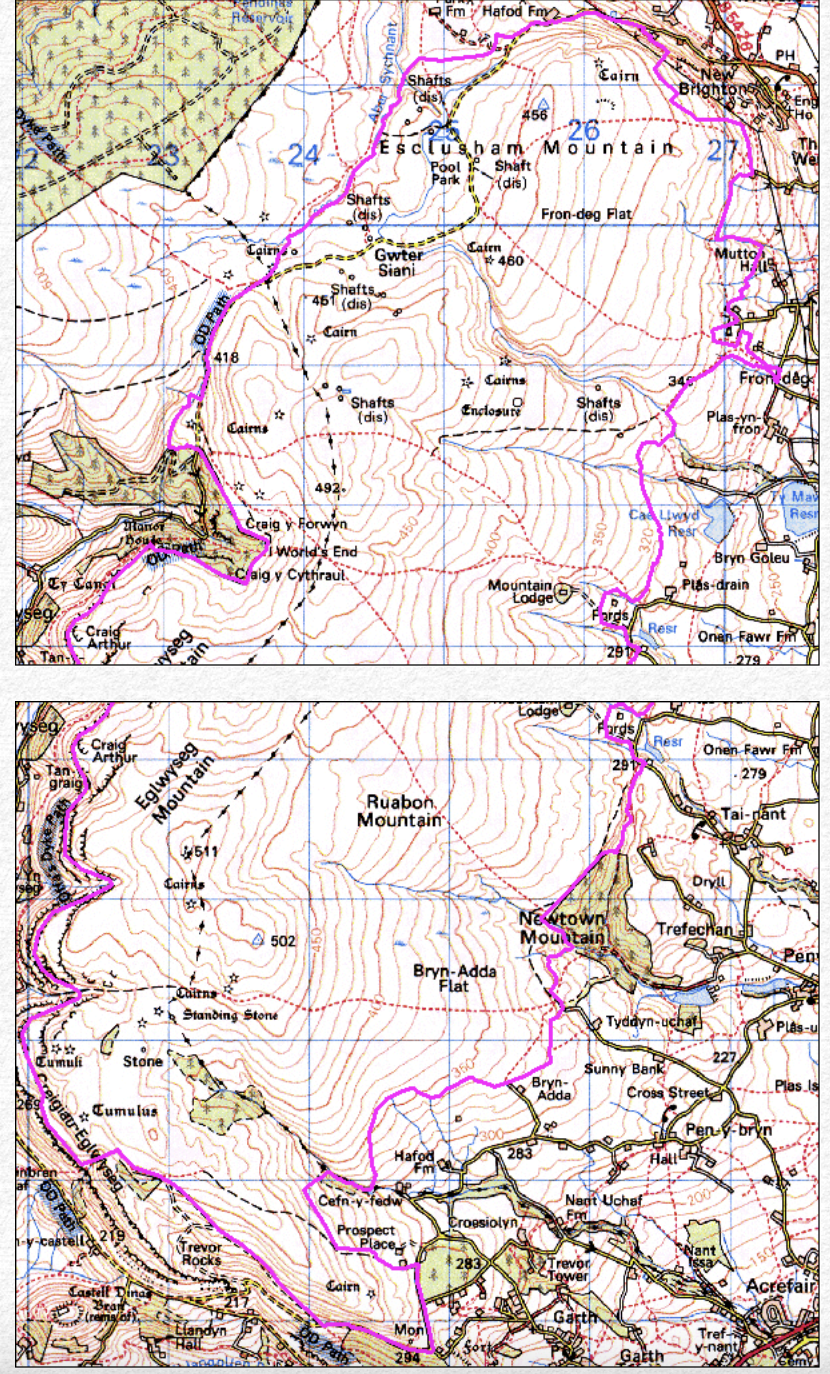
A landscape with extensive traces of mining for lead, silver and zinc ores is to be found on the northern side of Ruabon Mountain character area where the workings of Pool Park mine lie on the undulating, heather-covered moorland which includes natural sink-holes in the limestone.
The main period of mining activity was in the 1860s and 1870s and though earlier, undated workings appear to be represented by a number of the smaller shafts dotted along the veins, these are perhaps of 18th- or early 19th-century date, there being no explicit evidence of medieval mining in this particular area. The more intensive mining remains here cover an area of over 10 hectares, forming part of a more extensive though dispersed mining landscape extending to three or four kilometres southwards across the mountain to Pool Park, Cefn y Gist and Eglwyseg and northwards beyond the limits of the study area to Minera. Pool Park mine lay in the angle between the steep-sided valley of the Aber Sychnant stream to the west and the equally steep-sided valley of one of its tributaries to the north, dissecting the Carboniferous limestone plateau, at a height of about 400 metres above sea level. The waste heaps resulting from the sinking of shafts and ore processing still bare of vegetation and standing out starkly from the surrounding moorland.
The area has generally been unaffected by later activity, although with the notable exception of the destruction of the engine house, so that the earthworks which survive represent a largely fossilized mining landscape. Two runs of shafts follow the main veins, although the main area of activity is concentrated around a large shaft with extensive spoil tips, close to which are the remains of the engine house and a substantial embankment for a tramway linking the site to a second area of workings.
The remains of several smaller structures survive, along with evidence for possible hushing. As well as the main workings, the major landscape features include the two leat systems which drew water from the Aber Sychnant stream to supply Minera Mines, one also supplying Pool Park and Lower Park. Field evidence shows that some of the larger shafts were originally worked by means of horse whims, later replaced by a steam-driven engines supplied by water from artificial ponds and leats which also supplied power for crushing and processing the ore. The engines were housed in stone-built engine houses, which were mostly destroyed by the army in the 1960s after falling into disrepair. Two major leat systems are apparent. A more substantial one, sluiced from the Aber Sychnant some way upstream, bypassed the western side of the Pool Park mine and supplied the Minera mines, 2 kilometres to the north-east. A second leat, also sluiced from the Aber Sychnant upstream, was culverted under the tramway from Boundary Shaft to feed a large reservoir lying in the angle between the tramways to the south-east of the engine house. The reservoir evidently provided the main water supply for Pool Park and probably fed both the boilers of the engine house and the small waterwheel on the northern side of a dressing floor where the ores were processed. It then continued northwards across the mountain in the direction of Park Mine.
Slate quarrying and processing
The exploitation of the Silurian slates which outcrop in the western and southern parts of the area and resulted in the creation of a number of distinctive industrial landscapes. The Llangollen district formed a distinct region of the slate industry in north-east Wales and though small by contrast with the scale of the industry in north-west Wales was significant locally. Quarrying began in the 17th century, though the most intensive period of working came in the 19th and the earlier 20th centuries, following in the wake firstly of the canal and secondly the railway which transformed a predominantly local industry into one exporting outside the region to the Wrexham area and the English Midlands.
A number of groupings of quarries can be distinguished. One group of large quarries lay around the fringes of Llantysilio Mountain and the Horseshoe Pass in the Maesyrychen and Llantysilio Mountain historic landscape character areas at Oernant, Moel-y-faen, Clogau (Berwyn), Craig y Glan, Cymmo and Rhiw Goch, The original workings at Oernant lie in the conifer plantation below the Horseshoe Pass where early hillside working, mainly for the production of slate slabs but including some roofing slate is said to have been produced in the 17th century. From 1852 the transport of slate from the large Oernant, Moel y Faen, Berwyn quarries was facilitated by the opening of a tramway which skirted the eastern fringes of Llantysilio Mountain to feed the incline at Maesyrychain, within sight of Valle Crucis Abbey. The slate was transferred by this means to a lower tramway which ran to the Pentre Felin Slab and Slate Works sited on the canal just to the north-west of Llangollen.
The extensive open, hilltop workings with some underground workings at Moel-y-faen were mainly developed following connection to canal by an extension of the Oernant tramway in 1857, though by the end of its working life in the 1940s slate was being carted away from the quarry by lorry. Traces of buildings are still visible including dressing sheds and traces of steam winding house or sawing mill, and smithy. Also visible are the line of tramway with some slate sleepers still clearly visible. A complex of workers’ cottages at Tai-newyddion, to the north of the study area, are still occupied. The shallow, open hilltop workings at Clogau (Berwyn) cover an extensive area. Originally finished products, mainly slab were dispatched by incline down to the road, but later the Oernant tramroad served it. The production of specialist slate products still continues to the present day on a reduced scale. The hillside workings at Craig y Glan on the northern edge of Llantysilo Mountain operated in 1870–80s, being closed in 1940s, then depending exclusively on road transport. The small hillside quarry at Rhiw Goch near Cymmo, to the west of Rhewl included some underground workings and remained in operation from the 1840s up until the Second World War.
A second group of smaller quarries lay near Pentredwr at Craig Wynnstay, Ffynnon y Gog, and Foel in the Pant-y-groes historic landscape character area. These quarries were again mainly in production in the later 19th and earlier 20th centuries. The workings at Ffynnon y Gog and Foel are now largely hidden by later conifer plantation though some traces of quarry buildings and other structures still survive. A further small group of quarries lay in the Dinbren character area at Aber-gwern, Eglwyseg and Pant Glas. Aber-gwern was a small hillside quarry with a small dressing shed and other buildings which appear to have all closed by the 1920s, though some traces of buildings and structures are still visible in addition to the quarry sites themselves. Finally, a small, possibly mid 19th-century slate quarry lay on the hills to the south of Llangollen at Craig y Dduallt in the Craig-y-dduallt historic landscape character area.
The Pentrefelin slate works, dating from the 1840s, lay on the canal wharf and were later provided with a railway loading point. The mill was powered by a waterwheel driven by the canal itself and handled material brought from the Horseshoe Pass quarries by the Oernant tramway. It continued in operation until the 1920s despite tipping problems and complaints about river pollution. The former slate works were acquired by the White Sand and Silica Company in the 1940s, providing ground quartz from sandstone quarried on the Black Mountain near Nerquis and transported to Pentrefelin. It supplied the vitreous enamelling market, steel foundries and fine cement trade during the Second World War and thereafter up until the 1960s, the buildings subsequently becoming taken over by the Llangollen Motor Museum.
Limestone quarrying and lime manufacture
The coming of the canal at the end of the 19th century and the early years of the 20th century led to an expansion of the lime production industry in the eastern part of the area in the Trevor Uchaf and Cysyllte historic landscape character areas, making use of coal imported from the Ruabon coalfield. Canal-side limekilns were in operation at on the south side of the valley at Froncysyllte from the later 18th century onwards, producing lime for both agricultural and industrial purposes, transported as far as Cheshire, Staffordshire and the Midlands. The kilns were supplied by stone quarried from the isolated outcrop of limestone at the Pen y Graig quarries on the hillside above Froncysyllte, transported downhill by a series of tramroads and inclines, and gave rise to the small nucleated settlement at Froncysyllte. The limekilns on the opposite side of the valley at Tref-y-nant were in operation from the 1830s. These were based upon limestone brought down from Trevor Rocks where there are also many surviving remains of the limestone industry including both larger and smaller quarries, former tramlines which carried for transporting the quarried rock, several banks of limekilns and a number of more dispersed single limekilns. Several inclines were constructed which transported quarried material to the canal and railway and the dispersed settlement of miners’ cottages at Trevor Uchaf. The local lime industry underwent a decline at about the end of the 19th century, though quarrying for limestone was to continue at the Pen y Graig quarries up to the 1950s.
Brick and tile manufacture
A flourishing brick and tile industry emerged in the Cysyllte character area during the second half of the 19th century based upon the good quality clay from the marl beds and coal deposits available locally in the Ruabon Coalfield. The industry also benefiting from the proximity to the canal and railway and was ideally sited to meet the demands of the expanding industrial settlements of the Wrexham area and the growing centre of tourism at Llangollen. The former brickworks at Garth were in operation near the Australia Arms public house in 1862, operating at first with a single kiln near the road, which produced ‘large quantities of good, sound and serviceable cherry red bricks, which are well adapted for all ordinary building purposes’. B y the First World War the works was producing silica bricks for the steel industry and ganister, a plastic cement used for iron founding. Production eventually came to an end in 1979 as a consequence of the recession in the steel industry. The works are now demolished though there are some ruins at the back of the site and part of former offices still survive on the roadside. The earliest record of brickworks at Tref-y-nant is in 1852 and by the 1860s it was operating six kilns. The Tref-y-nant brickworks produced firebricks, chimney pots and ornamental terracotta goods, being one of four local works James Coster Edwards which became the most successful brickmaking companies in north-east Wales. The works specialised in the production of glazed sanitary pipes, for which there was a great demand following the new sanitary regulations which came into force after the passing of the Public Health Acts of 1848 and 1858. Clay was quarried from opencast holes and by pit mines, the opencast exposing strata of coal not extracted commercially, the clay quarried at Tref-y-nant produced wares of a pale buff colour which were ideal for sanitary stoneware pipes. The Tref-y-nant works had closed by 1958 having for several years produced red floor tiles. Purchased by Monsanto Chemical Works, the old brickworks having been mostly demolished and left to become overgrown, the only remnants of the former works surviving intact being the two brick piers of the office gates.
Transport and Communications
The Vale of Llangollen has provided an important access route through the mountains since early times, linking the borderland area with the lands of central Wales further to the west since early times. The crossing of the Dee at Llangollen also provided an important link northwards to the Vale of Clwyd.
Bridges across the Dee
A bridge across the river at Llangollen has been in existence since at least the 13th century, there being documentary evidence for the repair of the bridge here in 1284. A subsequent bridge is said to have been built by John Trevor in the mid 14th century, but the present bridge is probably originally of about 1500, with major repairs in 1656, with an additional span being added in 1863 across the railway. The bridge has since been widened twice on the up-river side, once in in 1873 and again in 1968–69. Thomas Pennant’s Tour in Wales published in 1783 noted that it was considered one of the ‘Tri Thlws Cymru, or three beauties of Wales’. It also features in the anonymous verse entitled The Seven Wonders of Wales.
Pistyll Rhaeadr and Wrexham Steeple, Snowdon’s mountain without its people, Overton yew trees, Gresford bells, Llangollen bridge and St Winifred’s well
A former Victorian castellated folly at the north end of the bridge was demolished in 1939.
Other early crossings of the Dee were no doubt by ferry or by ford, said to have been a ferry at Cysyllte in the late 14th century. The stone-built bridge further downstream at Pont Cysyllte was built in the 1690s, being substantially remodelled in the later 18th century. A further notable crossing of the river Dee was the first chain bridge at Berwyn, to the west of Llangollen, built by Exuperius Pickering in 1814 to take coal across the river for delivery to Corwen and Bala. In practical terms this was replaced by the stone-built King’s Bridge 1906, the original chain bridge being replaced by a suspension bridge in 1929.
Turnpike Roads
Considerable improvements were made to the major routes westwards to Corwen and northwards across Llantysilio Mountain to Ruthin by the turnpike trusts during the second half of the 18th century. Thomas Pennant in his Tour of Wales published in 1783, for example, mentioned the ‘excellent turnpike-road leading to Ruthyn’ past the Pillar of Eliseg. This was the former route across the mountains via Pentredwr, by way of the pass known to Pennant as Bwlch y Rhiw Velen. In 1808, according to the antiquary Richard Fenton
The Road ascending from the Vale, is . . . prodigiously steep, and continues so for a mile and a half. Then we come to a Mountain track and open an extensive View. See the Arrennig, our old acquaintances, and have a clear View of Snowdon’.
A less demanding turnpike road, the now famous Horseshoe Pass (A542), was constructed in 1811, to avoid this steep slope, equipped with milestones and a turnpike gate just to the north of the Britannia Inn.
Telford’s Holyhead Road

The present A5 was further considerably improved as part of the major improvement between 1815–26 of the London to Holyhead Road — the Great Irish Road — strengthening, as a matter of political expediency, the physical links between the centres of government in Whitehall and Dublin in the years following the 1800 Act of Union between England and Ireland. This was one of most ambitious and influential road-building schemes of the 19th century. It was an outstanding feat of civil engineering for its day, made possible by the generous funding awarded by Parliament and arguably the first major state-funded road-building programmes of modern times. The Holyhead Road had a relatively short heyday in the late 1820s and 1830s, however, being superseded for the purposes of long-distance travel by the London to Holyhead railway in the middle of the nineteenth century. The decline in importance of the road in the second half of the nineteenth century undoubtedly contributed to the remarkable degree of survival of much of the original work. The road has enjoyed a new lease of life since the invention of the internal combustion engine in the early twentieth century and today is seen as a living and working industrial monument, to be cherished and sympathetically managed in its own right. It is regrettable that much of the original character of Telford’s road has been spoilt by insensitive ‘improvements’ in recent years, but still surviving are some stretches of original roadside walling, road revetments, and a number of characteristic milestones with cast-iron plates set into upright sandstone pillars.
Llangollen Canal
Construction work on the canal running through the Vale of Llangollen began in 1795 and was completed in 1808, though open to some traffic in 1805. It was conceived, according to the cast-iron plaque on one of the piers of the Pontcysyllte Aqueduct, as being ‘for the mutual benefit of agriculture and trades’. It formed part of a canal system linking the Mersey with the rivers Dee and Severn, the name Llangollen Canal, which only became commonly used in the 1940s, is the name of the section from Welsh Frankton in Shropshire and the Horseshoe Falls weir at Llantysilio, west of Llangollen, where it was supplied with water from the river Dee. The canal gave access to the Ruabon collieries, and stimulated the growth of the limekilns and pottery works at Froncysyllte and Tref-y-nant, extensive basin with railways through the Acrefair collieries and chemical works to the Plas Kynaston iron works and Cwm Mawr stone quarries.
Construction work on the Pontcysyllte Aqueduct began in 1795 and was completed in 1805, for the purpose of carrying the canal across the river Dee. This masterpiece of engineering, regarded as the finest aqueduct in Britain, was designed by Thomas Telford working under William Jessop the most prolific canal engineer of the period. Tall slender stone pillars and arches support an iron trough over 300 metres in length just under 40 metres above the river Dee which runs below it. The height of the aqueduct required innovative techniques to replace former heavy construction techniques which had depended upon double skins of masonry sealed with puddle clay. Instead, the aqueduct was carried by an trough made from cast-iron plates bolted together, supported beneath by cast-iron ribs, the ironwork being cast by William Hazledine, one of the leading iron founders of the period at the nearby Plas Kynaston Ironworks, about 450 metres to the east of Trevor Wharf, first constructed to carry out the contract. The embankment on the south side of the aqueduct is one of the largest canal earthworks ever constructed, built from material quarried to form the canal cutting and tunnel near Chirk, about 5 kilometres to the south. Trevor Wharf, with spacious wharfs for coal, timber and lime, was served by railways from the adjacent coal mines and the Plas Kynaston ironworks. Surviving ancillary buildings and structures include dry docks, a canal hotel, former warehouse and lengthman’s house.
Most of the road bridges crossing the canal within the historic landscape area are of the humped-back type, many making use of brick or stone or a combination of the two, as well as on lifting bridge just to the south of the Pontcysyllte Aqueduct. Originally intended as a means of conveying agricultural produce, the canal became an important factor in the industrial development of the area. The canal became a tourist attraction from its early years. The Reverend Bingley, for example, was amongst the first to write about the aqueduct in a journal kept during a tour of north Wales in 1798, even before the piers had been completed and the iron trough added to the top.
The Vale of Llangollen Railway
Llangollen originally served by the Llangollen Road halt at Whitehurst, north of Chirk, which opened in 1849 on the Shrewsbury and Chester Railway, passengers transferring to coaches travelling along the Holyhead Road. The railway was initially opened in 1861 from Ruabon to Llangollen as the Vale of Llangollen Railway, branching from the Shrewsbury and Chester Railway south of Ruabon, running via Acrefair and Trevor. The railway was subsequently extended westwards as the Llangollen and Corwen Railway. This reached Corwen in 1865 via the Berwyn Tunnel which took a year to complete, and subsequently to the north Wales coast at Rhyl via the Vale of Clwyd Railway, branching at Corwen by 1864, and to the west coast of Wales by means of the Bala and Dolgellau Railway by the late 1868.
For a period of nearly a century the railway took over much of the traffic formerly carried by road and canal. It became an important means of exporting slate, limestone and timber balanced by imports of foodstuffs, barley and malt for supplying the Llangollen breweries, and for tourists. The picturesque Dee Valley, surrounded by the Berwyn, Llantysilio and Ruabon mountains had been favoured by tourists since the late 18th century, the railway offering one of the countries most scenic routes from Ruabon to Barmouth via Llangollen and Bala.
All freight services except Ruabon to Llangollen ceased in 1964, this being withdrawn in 1968. The line between Llangollen and Carrog to the west is now privately operated by the Llangollen Railway Society, but preserved elsewhere along the dismantled course of the railway line are embankments, cuttings, road crossings and bridge abutments which represent significant historic landscape features relating to the history of transport in the area.
Cultural Landscapes
The dramatic topography of the Vale of Llangollen has inspired a long tradition of literary and artistic associations since early medieval times which have themselves influenced the ways in which the landscape has been perceived and developed — having influenced certain aspects of its architectural heritage, the creation of designed landscapes, and the conservation of natural features.
Folklore and medieval poetry
As elsewhere in Wales, the earliest cultural associations within the Vale of Llangollen are probably to be seen in folklore associated with a number of natural features which perhaps originate in the early medieval period if not earlier. This is most notably focused on Craig Arthur and Craig y Forwyn (‘Maiden’s Crag’) — place-names associated with two of the prominent outcrops of the dramatic limestone escarpment of Eglwyseg Rocks.
Subsequent associations in the early medieval and medieval periods are predominantly with reference to structures or buildings created within the natural landscape, and frequently arose through royal or ecclesiastical patronage. The Pillar of Eliseg, the base of a stone cross prominently sited in the Eglwyseg valley, was erected in the first half of the 9th century by Cyngen in honour of his great-grandfather Eliseg who had reunited the kingdom by retaking land once conquered by the English. In 1696 the antiquarian Edward Lhuyd recorded the original inscription on the Pillar of Eliseg, before it had deteriorated to its now largely illegible state. The inscription on this symbolically important monument traced the legendary descent of the royal house of Powys from the early 5th-century king Gwrtheyrn (Vortigern), the late 4th century Macsen Wledig (Magnus Maximus), and a religious blessing from St Germanus of Auxerre, thus laying down political and territorial claims reaching back to the late Roman world. The origin of the place-name element eglywseg in Afon Eglywseg and Creigiau Eglwyseg is hotly debated, but some authorities have been considered that the place-name element are derived from Eliseg.
Perhaps the earliest record of place-names in the vale appeared in the 9th or 10th cycle of poems known as Canu Llywarch Hen (‘Song of Llywarch the old’), which alludes to the settlement of Llangollen and the pass known as Bwlch y Rhiw Velen northwards over the mountains to Ruthin with reference to the burial places of Llywarch’s sons.
Further poetical associations were to be made in the early 13th century by the court poet Einion Wan whose surviving works include an englyn (an early metrical form of Welsh poetry), which includes and elegy for Madog ap Gruffudd Maelor, the first ruler of the subdivided kingdom of Powys Fadog. Madog founded Valle Crucis Abbey in 1201, his son Gruffudd ap Madog built Castell Dinas Brân in the 1260s, two buildings which were later to acquire iconic status within the region.
Despite its loss of political and strategic significance following the Edwardian conquest of Wales in the 1280s, Dinas Brân was to feature in a number of literary works in the later 13th and 14th centuries. It appears in the prose romance known as Fouke le Fitz Waryn, a manuscript written in Old French and dating from the first half of the 14th century now in the British Library but based on a now missing late 13th-century verse romance. Also dating from the 14th century is the only extant work of the Welsh poet Hywel ab Einion, who composed a love-poem to Myfanwy Fychan of Dinas Brân, a young lady belonging to a branch of the Trevor family. The poem, said to have been left in the cleft of an oak tree on the slopes of the hill, was first published in an English translation by Thomas Pennant in his Tour in Wales. It includes the following memorable metaphor alluding to the impregnability of the hilltop:
Though hard the steep ascent to gain,
Thy smiles were harder to obtain
The medieval poem was to inspire the the well-known Victorian poem, Myfanwy Fychan, by the poet John Ceiriog Hughes. The poem, with its emphasis on moral standards, was written for the Eisteddfod held in Llangollen in 1858 and formed a model for Welsh love poetry in the second half of the 19th century.

In addition to its significant ecclesiastical and economic impact, the Cistercian abbey at Valle Crucis also became an important focus of cultural life within the region due to patronage by successive abbots, having associations with the poet Iolo Goch in the 14th century and with Guto’r Glyn and Gutun Owain in the 15th century. A well-known poem by Gutun Owain praises the hospitality of Dafydd ab Ieunan, the same abbot who had harboured the poet Guto’r Glyn in old age:
He’ll provide drink from flourishing orchards
And from wheat malt and splendid grapevines.
What the bees carry from the meadow corners
Will make liquors in his enclosures.
The best of fruits, like Gweirydd the Strong,
That grow from the earth, Dafydd bestows.
The Romantic movement
By now in ruins, Castell Dinas Brân and Valle Crucis continued to be referred to in works composed in the 16th and 17th centuries and were first remarked upon by early antiquaries. John Leland, the King’s Antiquary, visiting some time after 1534, mentioned ‘the castle of Dinas Brane was never a bygge thing, but sette al for strength in a place half inaccessible for enemies’. Early Romantic images of the ruined castle were conjured up in an englyn by the Denbighshire poet Roger Cyffyn in the late 16th or early 17th century, given in translation in George Borrow’s Wild Wales:
Gone, gone are thy gates, Dinas Brân on the height!
Thy warders are blood-crows and ravens, I trow;
Now no one will wend from the field of the fight
To the fortress on high, save the raven and crow.
General improvements in communications and greater mobility for social and leisure purposes by the elite classes resulted in a flurry of visitors to the area from about the middle of the 18th century together with the earliest appearance of published illustrations of the Vale of Llangollen, which were influential in promoting a picturesque image of its antiquities and scenery. Engravings of Valle Crucis were published by the Buck brothers in 1741–42 and by S. H. Grimm in 1770. The Welsh artist, Richard Wilson painted several views Dinas Brân in about 1770, one commissioned by Sir Watkin Williams-Wynn, exhibited at the Royal Academy in 1771. Wilson had previously studied landscape painting in Italy, the Dee valley with its fertile countryside and ruined castle and abbey forming ideal subject matter for lanscapes in the Italian fashion. Indeed, X-ray analysis of one of his views of Dinas Brân suggests that it was painted over an abandoned landscape of Tivoli. John Ingleby undertook a watercolour of the landscape near Llangollen including both Vale Crucis and Dinas Brân and in 1776 Paul Sandby published Views of North Wales which included one of the Vale of Llangollen from the east showing Dinas Brân.
Despite the influx of visitors, a strong local bardic tradition continued by such native poets as the Denbighshire poet Jonathan Hughes (1721–1805), born at Ty’n-y-pistyll farmhouse, Pengwern, near Llangollen, a competitor in the eisteddfodau organised by the Gwyneddigion Society. Hughes, whose epitaph was written by his friend Twm o’r Nant (Thomas Edwards) published several volumes of poetry both during his lifetime and shortly after his death.
The principal cultural influences upon the area were to come from further afield, however, and despite improvements to the network of turnpike roads some visitors went out of their way to pit themselves against the most arduous and adventurous routes that the area could offer. Thomas Pennant’s Tour in Wales, published in 1783, described the Eglwyseg valley as being ‘adapted only for the travel of the horsemen’, being
long and narrow, bounded on the right by the astonishing precipices, divided into numberless parallel strata of white limestone, often giving birth to vast yew-trees: and on the left, by smooth and verdant hills, bordered by pretty woods. One of the principal of the Glisseg rocks is honoured with the name of Craig-Arthur. That at the end of the vale is called Craig y Forwyn, or maiden’s rock; is bold, precipitous, and terminates with a vast natural column. . . . This valley is chiefly inhabited (happily) by an independent race of warm and wealthy yeomanry, undevoured as yet by the great men of the country.
The hills above Froncysyllte he described as having ‘a prospect uncommonly great. The distant view is boundless. One side impends over a most beautiful valley, watered by the Dee; diversified with groves and bounded towards the end by barren and naked rocks, tier above tier’. The notable houses of the gentry are also first described and praised in these works. Pennant noted that ‘Trevor house makes a handsome appearance’ though the timber-framed hall at Plas yn y Pentre was considered ‘a grotesque antient house, which gives variety to the scenery’. The first descriptions of the settlements of the Vale also appear at this period, Pennant describing Llangollen as
a small and poor town, seated in a most romantic spot, near a pretty common watered by the Dee, which emblematic of its country, runs with great passion through the valley. The mountains soar to a great height above their wooded bases; and one, whose summit is crowned with the ancient castle, Brân, is uncommonly grand. . . . I know of no place in North Wales, where the refined lover of picturesque scenes, the sentimental, or the romantic, can give a fuller indulgence to his inclination. No place abounds more with various rides or solemn walks.
Valle Crucis was to be described as ‘solemnly seated at the foot of the mountains, on a small meadowy flat, watered by a pretty stream, and shaded with hanging woods’ and engraving taken from watercolours of Dinas Brân, Valle Crucis and the Pillar of Eliseg by Moses Griffiths, were to be published in Pennant’s Tour in Wales. A further engraving depicting a view of Valle Crucis and Dinas Brân appeared in Henry Boswell’s Antiquites of England and Wales published in 1786.
Continental travel had become hazardous in the last years of the 18th century because of the French Wars and this was consequently a time when many would-be travellers sought adventures at home rather than attempting the Grand Tour. Numerous publications exploited the needs of this new and growing market. A Map of the Six Counties of North Wales was published in 1795 with engravings by Robert Baugh, which included a view of the ruins of Valle Crucis Abbey. An engraving of Llantysilo Hall was published in 1796 and a drawing of the Pillar of Eliseg was made by Thomas Rowlandson in 1797.

The last two decades of the 18th century was to see the Vale fully embraced by the European-wide Romantic Movement. By the 1780s Plas Newydd, then the small stone cottage of Pen y Maes on the southern outskirts of Llangollen, had become the home of two remarkable Irish ladies, Eleanor Butler and Sarah Ponsonby, who became known as the Ladies of Llangollen. Living there until their deaths in 1829 and 1831, they played host to an illustrious coterie of friends and acquaintances including members of the local Welsh gentry, as well as national and international figures from the world of art, politics and literature who represented a further generation of cultural tourists to the area. Visitors to Plas Newydd over this period of 40 years or more included such diverse personalities as Arthur Wellesly (later Duke of Wellington), the Duke of Gloucester, Prince Paul Esterhazy (Austrian minister of foreign affairs), Sir Walter Scott, Robert Southey, Josiah Wedgewood, Charles Darwin, Richard Sheridan, and Sir Humphrey Davey. In the grounds of Plas Newydd in 1824, overlooked by the imposing ruins of Dinas Brân, William Wordsworth composed the following lines about the ruined castle,
Through shattered galleries, ’mid roofless halls,
Wandering with timid footsteps oft betrayed,
The Stranger sighs . . .
He was subsequently to describe his visit to the Ladies of Llangollen in a letter to his friend Sir George Beaumont:
Called upon the celebrated Recluses . . . . We drank tea and passed a couple of hours with them in the evening, having visited the aqueduct over the Dee and Chirk Castle in the afternoon. . . . Next day I sent them the following sonnet from Ruthin, which was conceived, and in great measure composed, in their grounds.Glyn Cafaillgaroch, in the Cambrian tongue,
In ours, the Vale of Friendship, let this spot
Be nam’d; where, faithful to a low roof’d Cot,
On Deva’s banks, ye have abode so long;
Sisters in love, a love allowed to climb,
Ev’n on this earth, above the reach of time!The allusion to the Vale of Meditation in the above, would recall to the Ladies’ minds, as it was meant to do, their own good-natured jokes of the preceding evening . . .
Anna Seward was a further Romantic poet to visit the Ladies during this period, subsequently composing the following lines, published posthumously in her Llangollen Vale: with other poems:
Say, ivy’d Valle Crucis, time decay’d,
Dim on the brink of Deva’s wandering flood,
Your riv’d arch glimmering thro’ the tangled glade,
Your gay hills, towering o’er your night of wood,
Deep in the vale’s recesses as you stand,
And desolately great the rising sigh command.
The legacy of Eleanor Butler and Sarah Ponsonby was to long outlive them. The house was enlarged and elaborate timbering added in the 1880s by a subsequent owner, General John Yorke. Improvements were made to its gardens, including the erection of a summerhouse and ornamental bridges across the Cyflymen stream on whose banks the house was sited. Richard Llewelyn is said to have written How Green Was My Valley at the house in 1924, which was also briefly home to the Welsh National Theatre Company in the 1930s. Today the house and gardens are managed as a tourist attraction.
The Reverend Bingley was to note Plas Newydd on his tour in 1798:
the charming retreat of lady Eleanor Butler and Miss Ponsonby, which, however, has of late years been probably too much intruded upon by the curiosity of the multitudes of tourists who every summer visit Llangollen. . . . These two females, delighted with the scenery around Llangollen, when it was little known to the rest of the world, sought here a philosophical retirement from the frivolities of fashionable life, erected a dwelling that commands a fine mountain prospect, and have resided here ever since.
Bingley also wrote in 1798 about Castell Dinas Brân and gave a first-hand account of the construction of the Pontcysyllte Aqueduct, but was less flattering of the number of visitors to the town of Llangollen: ‘in the summer time I have more than once found it very unpleasant, from the crowd of travellers that are constantly passing on the roads to and from Ireland, and from the number of . . . tourists’.
Britain’s finest landscape painter, J. M. W. Turner, was to be numbered amongst these visitors in about 1798, when he sketched a view of the river Dee with Dinas Brân in the background. In 1808 he made a preliminary sketch of Valle Crucis again with Dinas Brân in the background, which became the subject of a later watercolour, the principal themes of which include one of the central themes of the Romantic art of the period, juxtaposing a shepherdess and labourers making hay in the foreground against the background of the natural scene including the ruins of abbey and castle.
A vociferous campaign against industrialization mounted by a number of prominent local figures in the early years of the 19th century was influential in the long-term conservation of the rural landscape of the Vale of Llangollen. Eleanor Butler and Sarah Ponsonby had long campaigned against quarries being opened within view of their windows, and they likewise campaigned against Telford’s Holyhead Road. They also rallied their friends and acquaintances, including members of the local gentry such as the Myddletons, Myttons, Mostyns and Williams Wynns, to oppose the construction of mills within Llangollen, which were considered ‘destructive’. Eleanor Butler wrote to solicit the support of Mr Thomas Jones of Llantysilio Hall, expressing her concern about ‘the peace Health and Morals of the Inhabitants’. According to the newspapers the ladies had threatened to abandon Llangollen:
Lady Eleanor Butler, and her fair friend Miss Ponsonby, who have for so many years been the fair recluses of the Vale of Llangollen in Wales are going to leave their beautiful seat no longer a retreat from the ‘busy hum of men’, by two extensive cotton mills having been erected near their abode.
By the summer of 1804, however, they were comforted by the knowledge that they would be invaded ‘neither by Buonaparte nor the Cotton Mills’. The canal, however, was apparently not included in their campaign against industrialization. Lady Eleanor Butler and Miss Ponsonby were amongst the party of distinguished guests occupying the first barges to cross the Telford’s Pontcysyllte Aqueduct amidst great pomp at the opening ceremony in 1805. Some later visitors such as Richard Fenton and his companion Sir Richard Colt Hoare visiting in 1808 were less approving, and whilst taking a trip along the canal, considered that ‘though it may bring commerce to a Country, yet in a picturesque point of view disfigures it’, though today, of course, the canal is regarded as one of the areas most cherished attractions.
The growth of tourism and cultural life in the 19th and 20th centuries,
Well-heeled and predominantly English tourists continued to flock to the Vale throughout the earlier part of the 19th century. The young physicist, Michael Faraday, visited the Pontcysyllte Aqueduct in the second decade of the century, remarking upon the embankment on the southern side of the valley ‘jutting out like a promontory’, and upon its slender stone piers which made it seem ‘light as a cloud’. A visit was made in 1823 by the essayist William Hazlitt who wrote ‘I went to Llangollen Vale, by way of initiating myself in the mysteries of natural scenery; and I must say I was enchanted with it . . . the valley was to me . . . the cradle of a new existence . . . on passing a certain point you come all at once upon the valley, which opens like an amphitheatre, broad and barren hills rising in majestic state on either side, with [quoting Samuel Taylor Coleridge] ‘green upland swells that echo to the bleat of flocks’ below, and the river Dee babbling over its stony bed in the midst of them’.
In 1829 a visit was made by the German composer Felix Mendelssohn, who sought refuge from the harpists sitting ‘in the hall of every reputable tavern playing so called fold melodies — that is to say, dreadful, vulgar, out-of-tune, trash with a hurdy-gurdy going on at the same time!’ by venturing into the surrounding countryside:
yesterday afternoon I had already climbed to the top of a high mountain, with the ruins of a Roman citadel [Dinas Brân] at the summit, had looked far out into the blue distance, and down to the dark, lonely valleys below – then climbed right back down into one of these quiet valleys, in which the walls and windows of an old abbey are covered and overgrown with lovely green trees – the abbey is right next to a rushing, babbling brook, mountains and rocky cliffs are spread all around, the choir of the church has been converted into a stable, the altar into a kitchen, above the tops of the gables you can see the tops of the beeches towering in the distance which could be a chapter in themselves
A similar picturesque image of the Vale of Llangollen is given by Samuel Lewis in his Topographical Dictionary published in 1833, setting the scene for a more popular appreciation of the attractions of the district that was to burgeon later in the century:
The situation of Llangollen on the mail coach road from London through Shrewsbury to Holyhead causes it to be enlivened by the daily passage of travellers; and its inhabitants derive considerable advantage from the number of persons who visit it in the summer season, and make this their temporary abode, for the purpose of enjoying the scenery of the neighbourhood, which is equally pre-eminent for its grandeur and sublimity, and for its picturesque and romantic beauty. The parish is very extensive, and the Vale of Llangollen is deservedly celebrated as containing, in proportion to its extent, a greater variety of interesting objects, and a more beautiful and striking combination of the milder and nobler features of pleasing and majestic scenery, than probably any other in the principality.
The dramatic outcrops of Vale of Llangollen became a source of geological wonder and speculation from at least the mid 18th century onwards. Thomas Pennant in his Tour of Wales published in 1783 writes of the ‘astonishing precipices’ of Eglwyseg ‘divided into numberless parallel strata of white limestone, often giving birth to yew trees’.
Llangollen was the natural starting point for the epic geological transect across north Wales by Professor Adam Sedgwick and Charles Darwin in August 1831. Principally intended to point out the errors in the Geological Map of England and Wales published by George Bellas Greenough in 1820, it also provided Darwin with a grounding in ‘how to make out the geology of a country’, just before setting out on the momentous voyage of the Beagle. The local cultural life of the district was to receive a fillip in the middle of the century, with the National Eisteddfod held in Llangollen in 1858, at which, as noted above, the Silver Crown was won by John Ceiriog Hughes for his now well-known poem Myfanwy Fychan.
The tourist industry was being actively promoted locally from the 1880s, the period between then and the end of the first decade of the 20th century seeing a rapid expansion in hotels, inns and boarding houses in Llangollen. The attractions of the area were detailed in a number of new publications such as Jones’s Picturesque Views of 1880, which enable the improvements that were being made for visitors to be traced. Thus Black’s Picturesque Guide of 1870 noted that the ‘old and mean’ houses which formerly existed in the town were being ‘gradually giving place to modern and more handsome dwellings’. In 1898 travel writer A. G. Bradley was to write of Llangollen, long seen as a blight in the vale: ‘the village has this long time ceased to be the unsophisticated Arcady whose deficiencies – matter nothing – since it is the situation and the surroundings which make it famous’. The ultimate accolade that the writers of the age could give came from John Ruskin who declared that ‘the Dee itself is a quite perfect mountain stream, and the village of Llangollen – one of the most beautiful and delightful in Wales’.
Long-standing attractions had been Castell Dinas Brân and Valle Crucis Abbey, to which canal trips and the picturesque walk to the Horseshoe Falls had been added with the coming of the canal in the early years of the 19th century. New diversions created for tourists in the period up to the first few decades of the 20th were to include the Victoria Promenade along the riverside in Llangollen, a camera obscura and tea-room within the castle ruins on Dinas Brân, and the Panorama Walk, high on the hillside below the Trevor Rocks. The coming of the railway had taken trade away from the canal and enabled the canal to be fully exploited by pleasure boats. Day visitors or weekly boarders arriving by road, rail or on foot across Ruabon Mountain from the industrial towns and cities of north-east Wales and the Midlands. By the end of the 19th century there were so many visitors arriving by train from the Midlands especially that in 1897 the railway platform was extended, and the waiting room at the station enlarged. Additional facilities in Llangollen and the surrounding district were provided to capitalise on increased demand which all had an impact upon the physical aspects of the environment, including shops, tea rooms, hotels and lodging houses. Horse-drawn vehicles and later motor buses were needed to convey visitors to accommodation and excursions to the Horseshoe Falls or Valle Crucis. Queen Victoria was herself to visit the Llangollen in 1889 at perhaps the height of the Victorian tourist trade, recording in her diary the visit she made to the Martins of Bryntysilio in its pleasure grounds overlooking the Horseshoe Falls:
drove up the beautiful wooded, mountain-girt, deep valley, dotted with villas and cottages, to Bryntysilio, the well-known residence of Sir Theodore Martin, who with Lady Martin received us as the door. The place is beautifully situated, and the house is furnished and arranged with the greatest taste. They showed us all their rooms and his study, with the table at which he wrote dearest Albert’s life. Had tea in the Drawing-room, during which a selected number of Llangollen choirs sang Welsh songs, in the pretty sloping garden. It is wonderful how well these choirs sing, being composed merely of shopkeepers and flannel weavers.
Literary associations in the early decades of the 20th century were to be maintained by John Cowper Powys whose Owen Glendower, published in 1940, was partly written in the ruins of Valle Crucis. Its early chapters are set in and around Dinas Brân, which is seen through the eyes of Powy’s young hero, Master Rhisiart:
There it was! There before him, towering up beneath a great bank of white clouds and against a jagged ridge of bare desolate rock, rose the castle of his imagination.For some minutes he remained spell-bound, absolutely caught out of himself, lost to everything but that majestic sight. It was not less, it was more than the picture he had in mind.
All ramparts ever built, all towers, all fortresses, all castles, seemed to him mere clumsy reproductions of the ideal perfection of Dinas Brân. It wasn’t that it was so large—and he could see clearly, even from this distance, that it was in a battered, broken condition—but it took into itself that whole hill it was built upon! Yes, that was the thing. Dinas Brân was not the stones of its human walls, not the majestic outlines of its towering embattlements, not its soaring arches and turrets and bastions; it was an impregnable mountain called up out of that deep valley by some supernatural mandate. It foundations were sunk in the earth, but they were sunk in more than the earth; they were sunk in that mysterous underworld of beyond-reality whence rise the eternal archetypes of all the refuges and all the sanctuaries of the spirit, untouched by time, inviolable ramparts not built by hands!
The historic landscape area was to become only marginally affected by the Second World War. Various firms were relocated to Llangollen during the war, occupying a number of former mill buildings. Llantysilio Hall became temporarily occupied by a school evacuated from Shropshire and Bryntysilio was occupied by the military. A new minor road was constructed across Ruabon Mountain from Minera to World’s End to improve access, and a pillbox was built for the Home Guard on the Horseshoe Pass. Practically the only active involvement in hostilities came during 1941 when extensive areas of the heather moorland on Ruabon Mountain were set ablaze by enemy bombers and parts of Plas Uchaf were damaged by an incendiary bomb.
The period since the Second World War brought a number of changes which are marked in the physical environment. Llangollen is now widely known for the International Music Festival established in 1947, promoting international peace and today playing host to more than six thousand competitors from over fifty countries taking part in competitions for choirs and dance groups. The festival was first held on the Recreation Ground above the town but subsequently moved to its present permanent site on land formerly belonging to Penddol Farm, and now equipped with new permanent structures. Dylan Thomas described in a radio talk broadcast in 1953, subsequently published in his Quite Early One Morning (1954), the impact of the festival on the town in its early years, describing the way in which it ‘spills colourfully, multilingually and confraternally into the streets of Llangollen and the surrounding countryside’.
The growth of private cars and the closure of the railway line in the 1960s, apart from the stretch now run privately running eastwards for a distance from Llangollen, resulted in an increase in the proportion of day visitors which led to a decline in the trade for boarding houses (many of which were converted to private residences). This in turn gave rise to pressures for the creation of car-parks in the town, including one which now occupies the former livestock market in the centre of the town.
Sources of Information
Information on the Vale of Llangollen and Eglwyseg can be found in various published sources.
Published sources of information
Abse, J., 2000. Letters from Wales, Bridgend.
Amgueddfa Llangollen 2003. The Spirit of Llangollen & Llantysilio.
Archer, A. A., 1959 , ‘The distribution of non-ferrous ores in the Lower Palaeozoic Rocks of North Wales’, Institution of Mining and Metallurgy Symposium.
Baring-Gould, S. and Fisher, J., 1907–13. The Lives of the British Saints.
Barlow, N., (ed.) 1958. Autobiography: The Autobiography of Charles Darwin, 1809-1882, London.
Baughan, P. E., 1980. A Regional History of the Railways of Great Britain, Volume 11, North and Mid Wales.
Bell, G. H., 1930. The Harmwood Papers of the Ladies of Llangollen.
Bennett, J., (ed) 1995. Minera: Lead Mines and Quarries. Wrexham: Wrexham Maelor Borough Council.
Bingley, W., 1814. North Wales delineated from two excursions through all the interesting parts of that highly beautiful and romantic country and intended as a guide for future tourists. London.
Borrow, G., 1862. Wild Wales.
Boswell, H., 1786. Historical Descriptions of New and Elegant Picturesque views of the Antiquites of the Antiquities of England and Wales . . . . London.
Bradley, A.G., 1898. Highways and Byways in North Wales, London (1901 edn).
Breese, G., 2001. The Bridges of Wales.
Bruce, J. R., 1921. ‘Pen-y-Gaer, Near Llangollen. An Investigation by a Committee of the Ruabon and District Field Club’, Archaeologia Cambrensis 76, 115–43.
Bruce, J. R., 1921. ‘A socketed celt, found on Garth Mountain, Llangollen’, Archaeologia Cambrensis 76, 146–7.
Buckle, G. E., 1930. Letters of Queen Victoria. London.
Burnham, H., 1995. A Guide to Ancient and Historic Wales: Clwyd and Powys. HMSO.
Butler, L. A. S., 1976. ‘Valle Crucis Abbey: an excavation in 1970’, Archaeologia Cambrensis 125, 80–126.
Cadw 1995. Clwyd: Register of Landscapes, Parks, and Gardens of special historic interest in Wales Part I: Parks and gardens, Cadw: Welsh Historic Monuments.
Cadw 1998 Landscapes of Historic Interest in Wales, Part 2 of the Register of Landscapes, Parks and Gardens of Special Historic Interest in Wales: Part 2.1 Landscapes of Outstanding Historic Interest. Cardiff: Cadw Welsh Historic Monuments. Available: http://www.ccw.gov.uk
Cadw 2001 Landscapes of Historic Interest in Wales, Part 2 of the Register of Landscapes, Parks and Gardens of Special Historic Interest in Wales: Part 2.2 Landscapes of Special Historic Interest. Cardiff: Cadw Welsh Historic Monuments. Available: http://www.ccw.gov.uk
Cadw 2003. Guide to good practice on using the Register of Historic Landscapes of Historic Interest in Wales in the planning and development process. Cardiff: Cadw
Clancy, J. P., 2003. Medieval Welsh Poems, Dublin.
Cliffe, C. F., 1850. North Wales.
Clwyd Fine Arts Trust nd , The Artist’s Journey through North Wales: Clwyd.
Connolly, A., 2003. Life in the Victorian Brickyards of Flintshire and Denbighshire. Llanrwst.
Coulter S., 1986. Yr Heol (The Rhewl), Llantysilio, a Welsh Village.
CPAT Historic Environment Record, Clwyd-Powys Archaeological Trust, Welshpool.
Crane, D., 2000. Walks through the history of rural Llangollen, Wrexham.
Davies, D. L., 1964. ‘County bridge building in Denbighshire in the mid-seventeenth century’, Denbighshire Historical Society Transactions 13, 59–218.
Davies, E., 1929. The Prehistoric and Roman remains of Denbighshire.
Davies, J. R., 1997. ‘Church, property and conflict in Wales, AD 600–1100’, Welsh History Review 18.3 , 404.
Davies, W., 1810. General View of Agriculture in North Wales. London.
Denbighshire Countryside Service 2003a. Dinas Brân Castle, Llangollen/Castell Dinas Brân, Llangollen.
Denbighshire Countryside Service 2003b. Denbighshire Landscape Strategy, Denbighshire County Council, 2003.
De Sélincourt, E., 1939. Letters of William and Dorothy Wordsworth: The Later Years, Part I, 1821–28. Oxford.
Dillon, M., 1985. Brick Tiles and Terracotta From Wrexham and Ruabon. Wrexham Maelor Borough Council.
DCMS 1999. World Heritage Sites: The Tentative List of the United Kingdom of Great Britain and Northern Ireland, Department for Culture, Media and Sport.
Edwards, I., 1965. ‘Iron production in north Wales: the canal era’, Denbighshire Historical Society Transactions 14, 141–84.
Edwards, I., 1969. ‘Industry at Llangollen’, Transactions of the Denbigishire Historical Society 18, 136–53.
Edwards, I., 1985 , ‘Slate quarries in the Llangollen district’, Denbighshire Historical Society Transactions 34, 91–120.
Edwards, I., 1987. ‘Gazetteer of Clayworks in the Wrexham and Ruabon District’, Denbighshire Historical Society Transactions 36, 46–84.
Edwards, I., 1988 , ‘Hughes and Roberts, Woollen Manufacturers, Dee Mill, Llangollen’, Denbighshire Historical Society Transactions 37 , 67–78.
Edwards, I., 193. Llangollen in Old Postcards.
Edwards, N., 1991. ‘The Dark Ages’ in Manley et al. 1991, 129–41.
Ellis, T. P., 1924. The First Extent of Bromfield and Yale A.D. 1315. London.
Elvers, R. (ed.), 1986. Felix Mendelssohn. A Life in Letters. New York.
Emery, A., 2000. Greater Medieval Houses of England and Wales, volume II: East Anglia, central England and Wales
Evans, D. H., 1995. Valle Crucis Abbey.
Evans, J., 1802. Tour through part of North Wales.
Evans, J., 1815. Beauties of England and Wales.
Faraday, M., 1819. Journal of a Tour Through Wales.
Fisher, J. (ed.), 1917. Tours in Wales (1804–1813) by Richard Fenton, Cambrian Archaeological Association.
Ffoulkes-Jones, G., 1980. ‘Llangollen and the tourists’, Clwyd Historian 7, 36–9.
Forde Johnston, J., 1976. Hillforts of the Iron Age in England and Wales.
Freeman, G. J., 1826. Sketches in Wales.
Frost, P., 1994. Clwyd Metal Mines Survey 1993: Consultation Draft, unpublished report, CPAT Report 88.
Frost, P., 1995. Clwyd Small Enclosures Rapid Survey: project report, unpublished report, CPAT report 127.
Hadfield, C., 1969. The Canals of the West Midlands, 2nd edn.
Harper, G. C., 1902. The Holyhead Road: the Mail Coach Road to Dublin, 2nd edn, London.
Hathaway, E. J., P. T. Ricketts, C. A. Robson, and A. D. Wilshere (eds), 1975. Fouke Le Fitz Waryn. Anglo-Norman Text Society. Oxford.
Hazlitt, William, 1817. On Going on a Journey.
Hewitt, R. S., 1977. A history of Castell Dinas Brân: with notes on Valle Crucis Abbey. Wrexham.
Hill, D. and Worthington, M., 2003. Offa’s Dyke: History and Guide. Stroud.
Hogg, A. H. A., 1979. British Hill-Forts: An Index, British Archaeological Reports, British Series 62.
Hubbard, E., 1986. The Buildings of Wales: Clwyd.
Jack, R. I., 1981. ‘Fulling-mills in Wales and the March before 1547’, Archaeologia Cambrensis 130, 7–130.
Jenkins, J. G., 1969. The Welsh Woollen Industry. National Museum of Wales.
Jervoise, E., 1936. The Ancient Bridges of Wales and Western England.
Jones, G. P., 1932. The Extent of Chirkland 1391–1393, London.
Jones, N. W., 1999. ‘Prehistoric Funerary and Ritual Sites: Denbighshire and Eastern Conwy’, CPAT Report 314.
Jones N. W., Walters, M., and Frost, P., 2004. Mountains and Orefields: Metal Mining Landscapes of Mid and North-East Wales, CBA Research Report 142.
Jones, T., (trans.), 1952. Brut y Tywysogyon or The Chronicle of the Princes: Peniarth MS. 20 Version, Cardiff.
Kemp, W. J., 1935. ‘Dinas Brân castle and hillfort’, Archaeologia Cambrensis 90, 323–6.
Keynes, R., 2002. Fossils, Finches and Fuegians: Charles Darwin’s Adventures and Discoveries on the Beagle, 1832-1836, London.
King, J. D. C., 1974. ‘Two castles in northern Powys: Dinas Brân and Caergwrle’, Archaeologia Cambrensis 123, 113–39.
Knight J. K., 1995. ‘The Pillar of Eliseg’ in Valle Crucis Abbey, Cadw Guide.
Knowles, D. and Hadcock, R. N., 1963. Medieval Religious Houses in England and Wales.
Lerry, G. G., 1959. ‘The industries of Denbighshire from Tudor times to the present day’ Denbighshire Historical Society Transactions 8, 95–132.
Lerry, G. G., 1949. Henry Robertson, Pioneer of Railways into Wales.
Lewis, S., 1833. A Topographical Dictionary of Wales, 2 vols. London.
Lewis, W. J., 1967. Lead Mining in Wales. Cardiff.
Lhwyd, E., 1909–11. Parochialia, Cambrian Archaeologial Association, 3 vols.
Llandegla 2003. Llandegla Then and Now, Llandegla Millennium Action Group.
Lloyd, J. Y. W., 1881. History of Powys Fadog, vol 4.
Lloyd-Williams, R. and Underwood, M., 1872. The Architectural Antiquities and Village Churches of Denbighshire.
Lord, P., 2000. The Visual Culture of Wales: Imaging the Nation. Cardiff.
Lynch, F., 1969. ‘Flint arrowheads from Minera, Wrexham’, Denbighshire Historical Society Transactions 18, 155.
Lynch, F., 2002. ‘Prehistoric funerary and ritual sites in Denbighshire and east Conwy’, Transactions of the Denbighshire Historical Society 51 (2002), 15–25.
Martin, R., 1999. ‘Changes in the Vale of Llangollen, 1790-1865’, Transactions of the Denbighshire Historical Society 48 , 52–73.
Manley, J., Grenter, S. and Gale, F. (eds) 1991. The Archaeology of Clwyd, Clwyd County Council.
Mavor, E., 1971. The Ladies of Llangollen. London.
Moore, D., 2000. ‘Thomas Pennant’s Vision of the Landscape’, Archaeologia Cambrensis 146 , 138–77.
Musson, C. R., 1994. Wales from the Air. Aberystwyth.
Nash-Williams, V. E., 1950. The Early Christian Monuments in Wales. Cardiff.
Owen, W. G. and Silvester, R. J., 1993. ‘Trefor Wharf, Llangollen Canal, Clwyd: archaeological assessment of the proposed redevelopment site’, unpublished CPAT Report 42.
Palmer, A. N. and Owen, J. E., 1910. History of Ancient Tenures of Land in North Wales and the Marches. 2nd edn, Frome.
Peacock, W. F., 1860. The Beauties of Llangollen and Chirk.
Pellow, T. and Bowen, P., 1988. Canal to Llangollen.
Pennant, T., 1773. A Tour in Wales. London.
Powys, John Cowper, 1940. Owen Glendower. New York.
Pratt, D., 1987. ‘Medieval People: The advowry tenants of Bromfield And Yale’, Denbighshire Historical Society Transactions 36, 9–11.
Pratt, D., 1997. The Dissolution of Valle Crucis Abbey.
Pratt, D., 1990. ‘The Marcher Lordship of Chirk, 1329–1330’, Denbighshire Historical Society Transactions 39, 5–41.
Pratt, D., 1995. ‘Valle Crucis Abbey, 1606’, Clwyd Historian 34, 23–27.
Price, G. V., 1952. Valle Crucis Abbey. Liverpool.
Pritchard, R.T., 1963. ‘Denbighshire roads and turnpike trusts’, Denbighshire Historical Society Transactions 12, 86–109.
Pugh, E., 1816. Cambria Depicta.
Quartermaine, J., Trinder, B., and Turner, R., 2003. Thomas Telford’s Holyhead Road: the A5 in North Wales, CBA Research Report 135.
Quenby, R., 1992. Thomas Telford’s aqueducts on the Shropshire Union Canal. Shrewsbury.
Radford, C. A. R. and Hemp, W., 1959. ‘Pennant Melangell, the church and shrine’, Archaeologia Cambrensis 108, 81–113.
Radford, C. A. R., 1971. The Pillar of Eliseg.
Radford, C. A. R., 1974. Valle Crucis Abbey.
RCAM 1914. Inventory of the Ancient Monuments of Wales and Monmouthshire – Denbighshire.
Rees, W., 1967. An Historical Atlas of Wales, 3rd edn.
Richards, A. J., 1991. A Gazetteer of the Welsh Slate Industry.
Richards, A J., 1995. Slate Quarrying in Wales.
Richards, M., 1969. Welsh Administrative and Territorial Units, Cardiff.
Roberts, D., 1998. Both Sides of the Border. An Anthology of Writing on the Welsh Border Region. Llanrwst.
Roberts, E., 2001. ‘The Impact of the Cistercians on Welsh Life and Culture in North and Mid Wales’, Denbighshire Historical Society Transactions 50, 13–23.
Roberts, G., 1959. ‘The Ladies of Llangollen’, Denbighshire Historical Society Transactions 8, 68–82.
Roberts, J. I., 1958. ‘Population of Llangollen from 1800–1851’, Denbighshire Historical Society Transactions 7, 162–4.
Roberts, J. I., 1960. ‘Early railway controversies at Llangollen’, Denbighshire Historical Society Transactions 9, 80–93.
Robinson, D., 1998. The Cistercian Abbeys of Britain.
Roscoe, T., 1836. North Wales.
Seward, A., 1796. Llangollen Vale: with other poems. London.
Shanes, E., 1979. Turner’s Picturesque Views in England and Wales 1825–1838. London.
Sherratt, G., 1990. A Hurried History of Llangollen.
Sherratt, G., 2000. An Illustrated History of Llangollen.
Sivewright, W. J. (ed.), 1986. Civil Engineering Heritage. Wales and Western England.
Silvester, R. J., 1995. Glyndwr Historic Settlements, CPAT Report 131.
Silvester, R. J., 1998. Deserted Medieval and Later Rural Settlements in Eastern Conwy, Denbighshire and Montgomeryshire, CPAT Report 251.
Silvester, R. J., 1999. Welsh Historic Churches Project. The Historic Churches of Denbighshire: church survey, CPAT Report 312.
Silvester, R. J. and Brassil, K. S., 1991. Mineral Workings in Clwyd and Powys: an archaeological assessment, unpublished report, CPAT Report 10.
Silvester, R. J. and Hankinson, R., 1995. Ruabon Mountain Uplands: field survey, Clwyd-Powys Archaeological Trust Report 133.
Simpson, W. T., 1827. Some Account of Llangollen.
Simpson, W. T., 1853. History of Llangollen and its vicinity.
Smith, B., 1998. Llywelyn ap Gruffudd. Cardiff.
Smith, B. and George, T. N., 1948. British Regional Geology: North Wales.
Smith, L. T., (ed.), 1906. The Itinerary in Wales of John Leland in or about the years 1536-1539. . .
Smith, P., 1988. Houses of the Welsh Countryside.
Soulsby, I., 1983. The Towns of Medieval Wales.
Stephens, M., 1986. The New Companion to the Literature of Wales, Cardiff (rev. edn, 1990)
Suggett, R., 2001. ‘Recent emergency buildings recording in Wales’, Transactions of the Ancient Monuments Society 45, 82, 89–90.
Thomas, Dylan, 1954. Quite Early One Morning.
Thomas, D. R., 1908-13. History of the Diocese of St Asaph, 3 vols, Oswestry.
Thomas, D., 1998. Pen y Coed Wood, Llangollen: archaeological assessment, unpublished report, CPAT Report 296.
Toller, H., forthcoming. ‘Pen Plaenau Roman marching camp’, Archaeologia Cambrensis.
Wheeler, R. E. M., 1925. Prehistoric and Roman Wales.
Wiliam, E., 1982. Traditional Farm Builidngs in North-East Wales 1550–1900, National Museum of Wales.
Wilkinson, L. U. (ed), 1958. Letters of John Cowper Powys to Louis Wilkinson 1935–1956. London.
Williams, D. H., 1974. The Welsh Cistercians, 2 vols, Tenby.
Williams, D. H., 1990. Atlas of Cistercian Lands in Wales.
Williams, D. H., 2001. The Welsh Cistercians, Leominster.
Williams, G., 1962. The Welsh Church from Conquest to Reformation.
Williams, G. V., 1999. ‘The Ellesmere Canal Navigation – a great public utility’, Denbighshire Historical Society Transactions 48, 23-36.
Wills, L. J., 1919. Geology of the Llangollen District.
Wilson, E. A., 1975. Ellesmere and Llangollen Canal: An Historical Background.
Wrexham 2003. Wrexham LANDMAP: Consulation Draft March 2003, Wrexham County Borough Council.
Wright, K. A., 1973. Gentle are its Songs.
The following historic landscape character areas have been defined within the historic landscape area.